Polar Books Catalogue
-
Sections : Antarctic; Arctic; Journal of the Manchester Geographical Society; Maps; Miscellaneous; Mountaineering; General Polar; Scott; Other travel; Whaling;

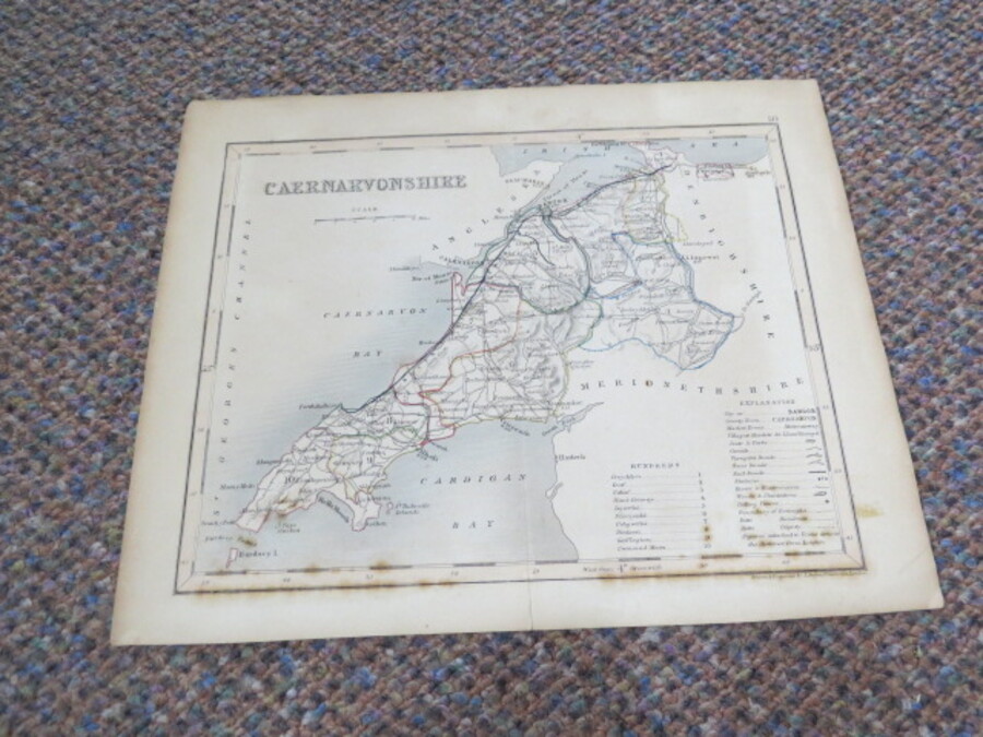
Author Archer, J (Drawn and Engraved by) Title Antique Map WALES CAERNARVONSHIRE Scale approximately 1:402,336 Price £5.00 Full Details
Add this to your basketRef:3448 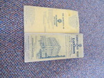
Author Automobile Association Title AA Throughway Map of London with Landmarks, Scale 1 and an eigth Inches to One Mile Comprising an Area Over 12 Miles Around London and Shewing New Roads Open and Under Construction Price £10.00 Full Details
Add this to your basketRef:3676 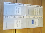
Author Automobile Association Title Automobile Association Day Drives x 4 (Shrewsbury,Reading,Bournemouth and Betws-y-Coed) Price £10.00 Full Details
Add this to your basketRef:4129 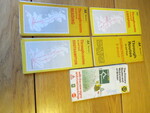
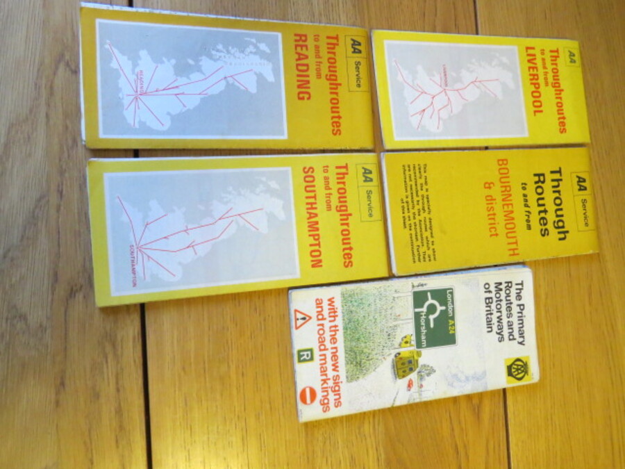
Author Automobile Association Title 5 Road Maps: 4 x Throughroutes to and from Liverpool, Reading, Southampton, Bournemouth and 1 The Primary Routes and Motorways of Britain Price £5.00 Full Details
Add this to your basketRef:4130 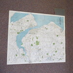
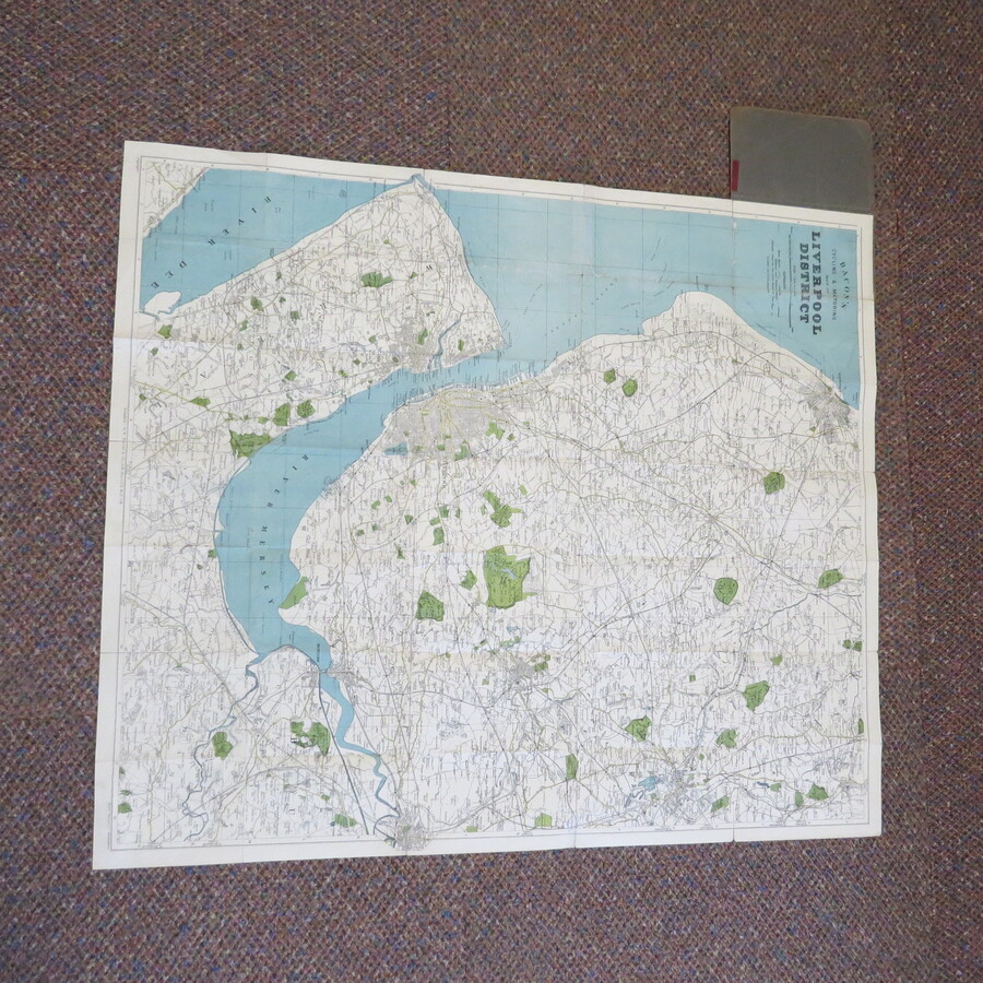
Author Bacon Title BACON'S CYCLING AND MOTORING MAP OF LIVERPOOL DISTRICT One Inch to the Mile. Price £15.00 Full Details
Add this to your basketRef:3970 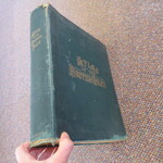
Author Bacon G.W. (Editor) Title Commercial and Library Atlas of The British Isles from The Ordnance Survey; with Index-Gazetteer etc. Atlas Price £550.00 Full Details
Add this to your basketRef:3980 
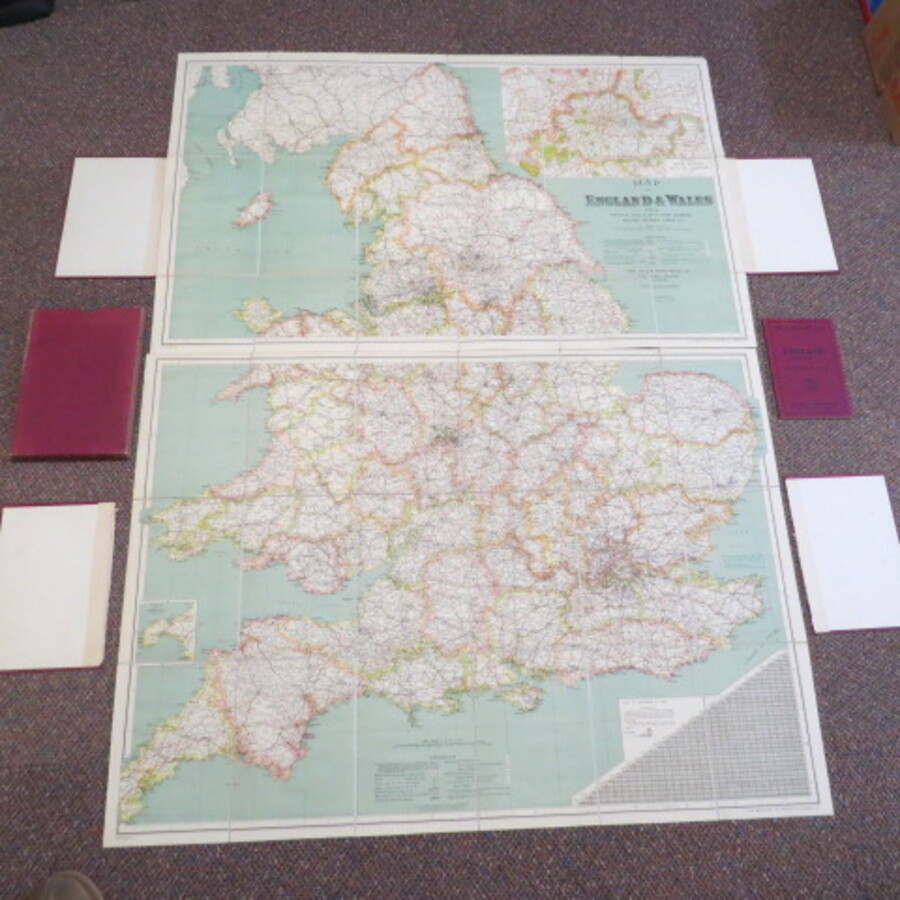
Author Bacon, G. W. and Co Title Map of England and Wales, showing Railways, roads with their numbers, mileage between towns etc., complete with booklet Index and Route Guide with Useful Information for Motorists Price £45.00 Full Details
Add this to your basketRef:3986 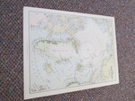
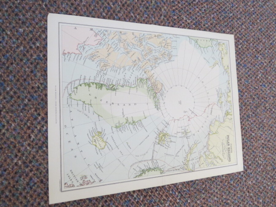
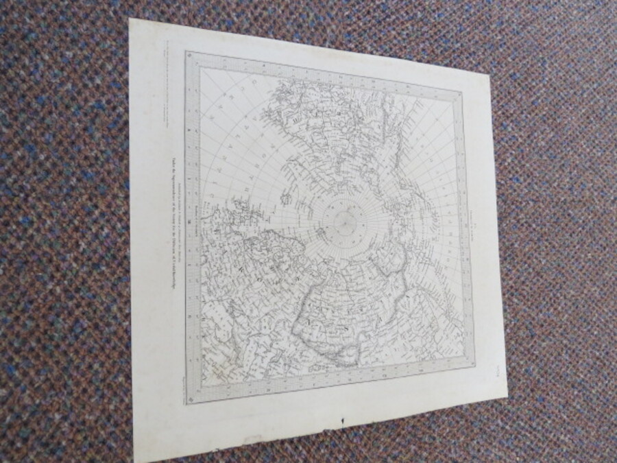
Author Bartholomew, J. Title NORTH POLAR REGIONS: With Results of Latest Explorations. Scale 1:200,000. Price £40.00 Full Details
Add this to your basketRef:4028 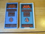
Author Bartholomew, John Title Bartholomew's Revised Half Inch Contoured Maps x 2 Maps: Great Britain, Sheets 29 and 36, Peak District and North Yorkshire Coast Price £5.00 Full Details
Add this to your basketRef:4112 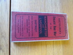
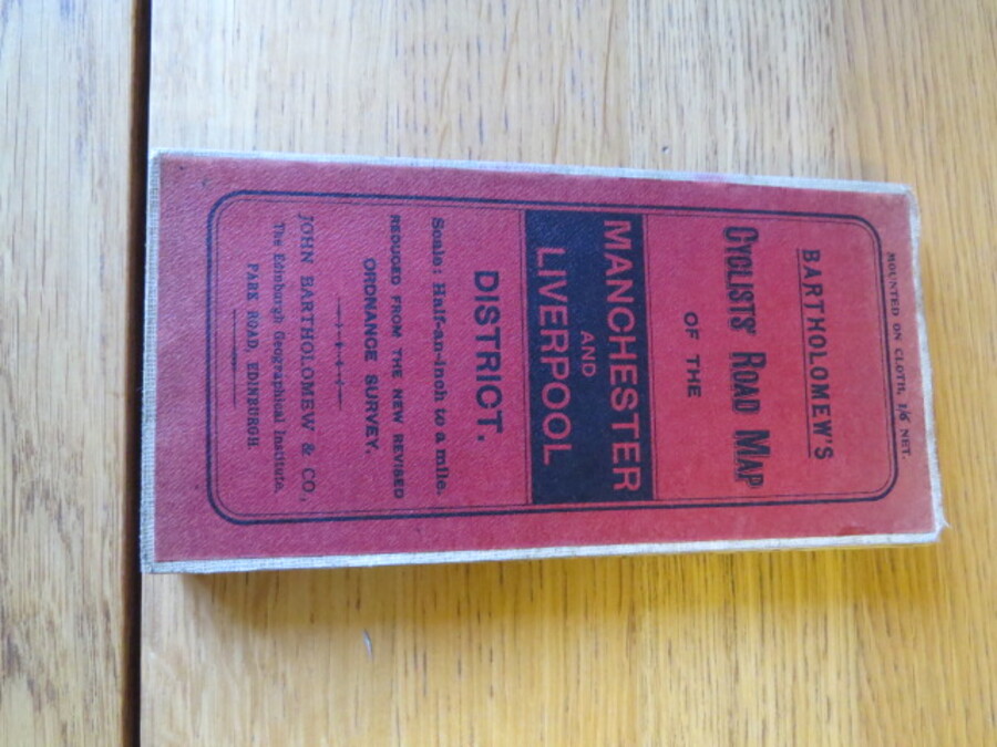
Author Bartholomew, John & Co., Title Bartholomew's Cyclists' Road Map of Manchester and Liverpool Districts reduced by permission from the new revised Ordnance Survey. Scale: Half an inch to a mile. Price £10.00 Full Details
Add this to your basketRef:4108 
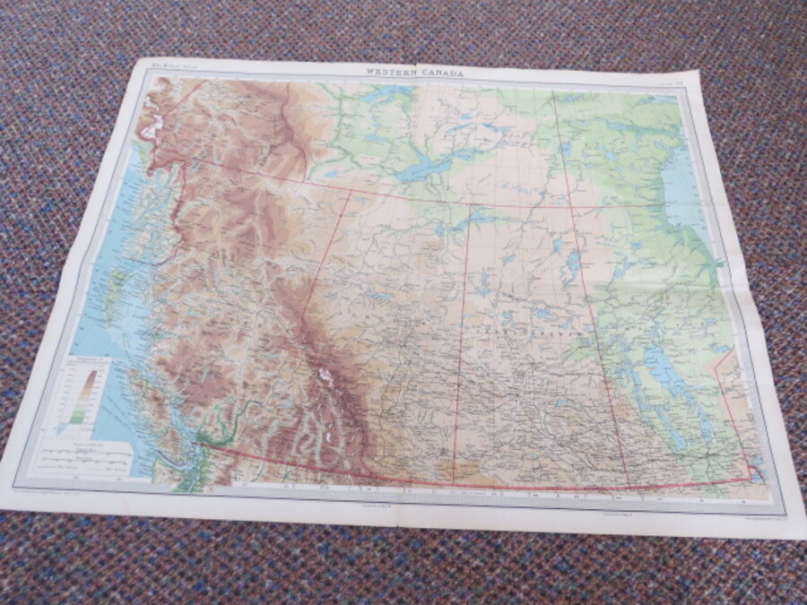
Author Bartholomew, John & Son Title Times Survey Atlas of the World Plate 39 (Map of Western Canada) Price £10.00 Full Details
Add this to your basketRef:4030 
Author Bartholomew, John & Sons Title Royal Irish Automobile Club (Touring Department) Ireland Map. Scale: 16 English miles to an Inch. Price £35.00 Full Details
Add this to your basketRef:4128 
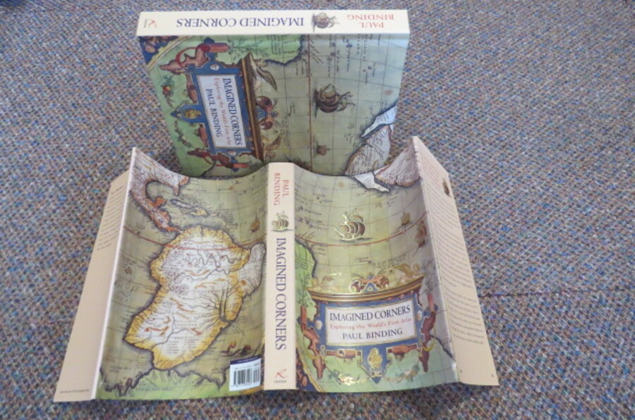
Author Binding, Paul Title IMAGINED CORNERS: Exploring the World's First Atlas Price £20.00 Full Details
Add this to your basketRef:4010 
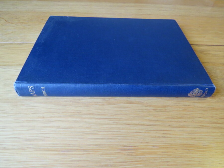
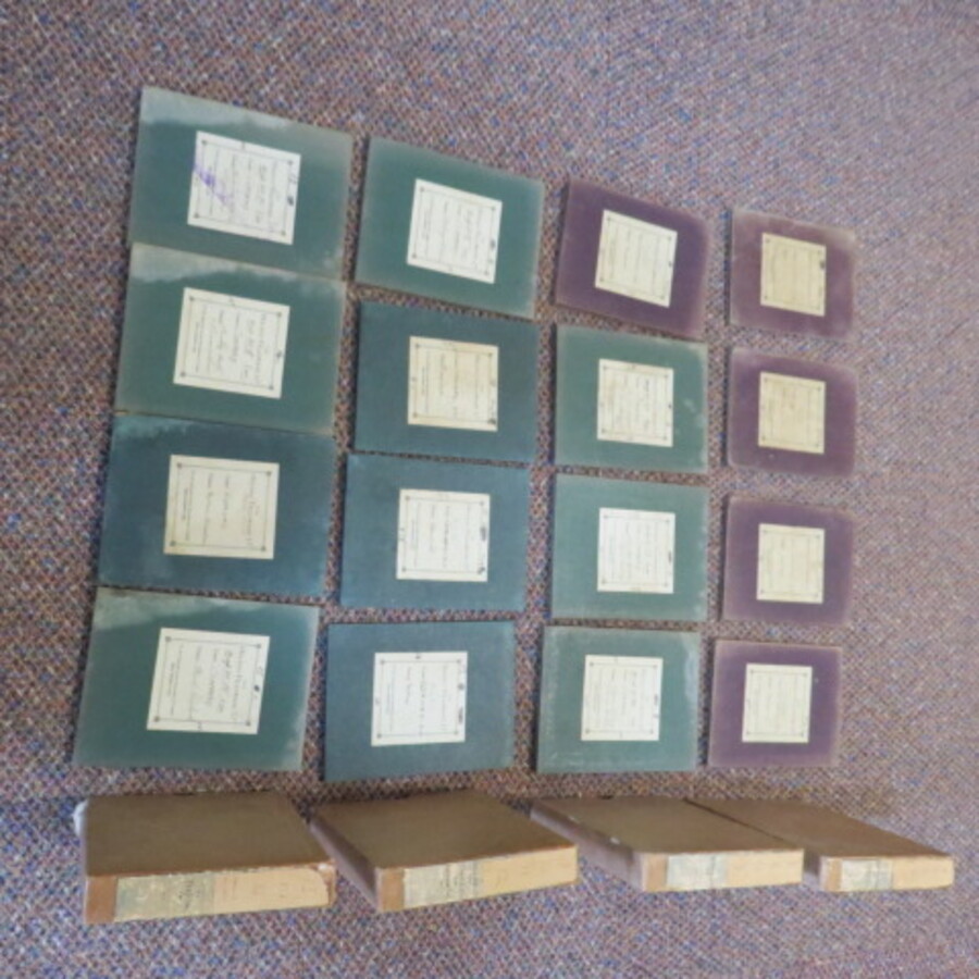
Author Birch, T.W. Title Maps: Topographical and Statistical Price £5.00 Full Details
Add this to your basketRef:4088 
Author Buquet, J (Cartographer) Title Argentinian Admiralty Chart No.63 Mercator Projection: De Cabo Penas a Cabo de Hornos Price £40.00 Full Details
Add this to your basketRef:4053 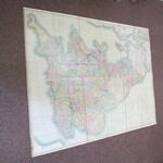
Author Cary, J Title CARY'S NEW SIX SHEET MAP OF ENGLAND AND WALES WITH PART OF SCOTLAND. Price £900.00 Full Details
Add this to your basketRef:3968 
Author Cary, J. Title CARY'S NEW MAP OF ENGLAND AND WALES WITH PART OF SCOTLAND, in 3 parts. Price £1000.00 Full Details
Add this to your basketRef:3960 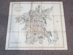
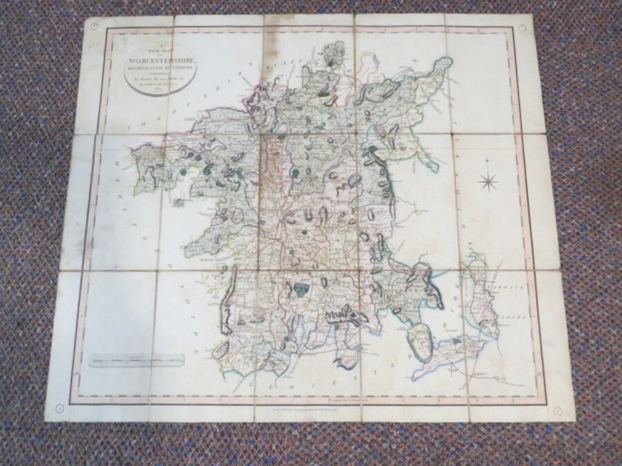
Author Cary, John Title A New Map of Worcestershire divided into hundreds exhibiting its roads, rivers, parks etc., Antique Map Price £25.00 Full Details
Add this to your basketRef:3581 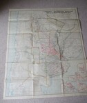
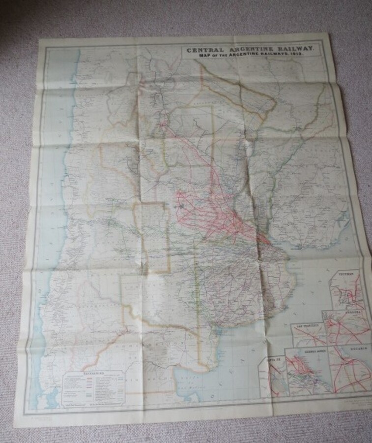
Author Central Argentine Buildings, Buenos Aires Title Central Argentine Railway Map of the Argentine Railways, 1913. Price £100.00 Full Details
Add this to your basketRef:4073 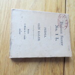
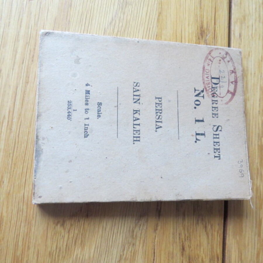
Author Colonel S.G. Burrard (Surveyor General) Title Degree Sheet No.1L Persia, Sain Kaleh. Map Scale: 1inch to 4 miles Price £500.00 Full Details
Add this to your basketRef:3969 
Author Creighton, R. (Engraver J. Dower) Title Lewis's A Map of England and Wales Divided Into Counties, Parliamentary Divisions and Dioceses Shewing the Principal Roads, Railways, Rivers and Canals Price £320.00 Full Details
Add this to your basketRef:3967 
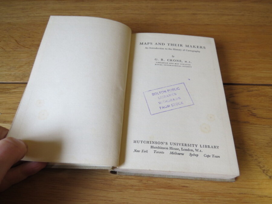
Author Crone, G.R. Title Maps and Their Map Makers: An Introduction to the History of Cartography Price £2.50 Full Details
Add this to your basketRef:4086 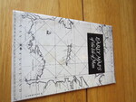
Author Cubbon, A.M. Title Early Maps of the Isle of Man: A Guide to the Collection in the Manx Museum Price £5.00 Full Details
Add this to your basketRef:4077 
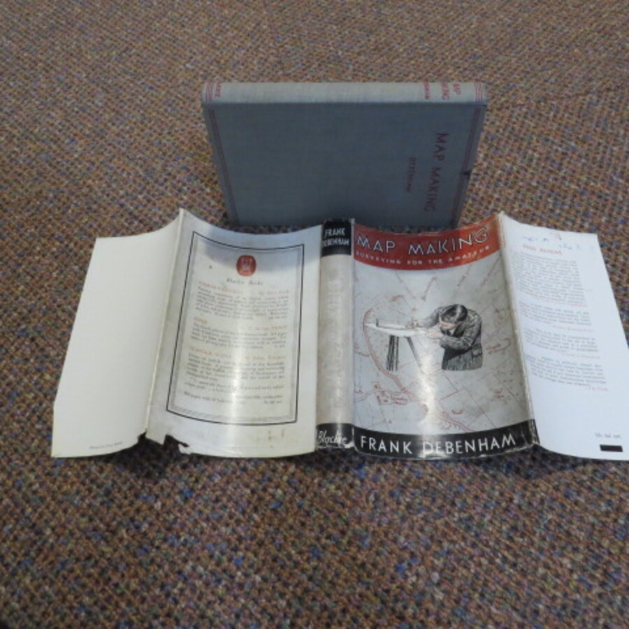
Author Debenham, Frank Title Map Making: Surveying for the Amateur Price £10.00 Full Details
Add this to your basketRef:3997 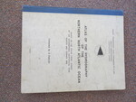
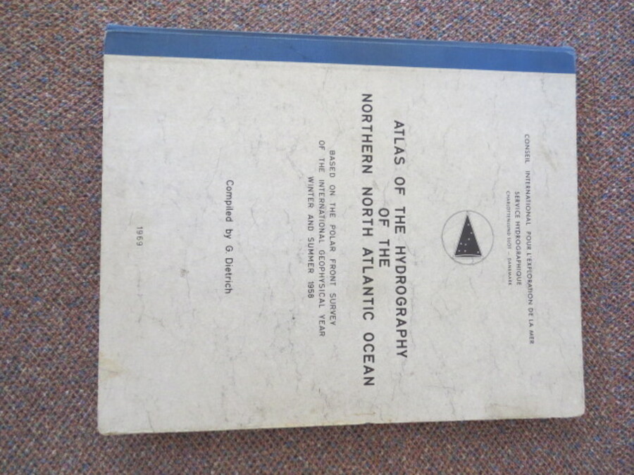
Author Dietrich, G. Title Atlas of the Hydrography of The Northern North Atlantic Ocean based on The Polar Front Survey of The International Geophysical Year Winter and Summer 1958 Price £40.00 Full Details
Add this to your basketRef:4284 
Author Dudley Stamp, L Title Land Utilisation Survey of Britain: Wrexham and Oswestry (Ordnance Survey six inch) Price £5.00 Full Details
Add this to your basketRef:4124 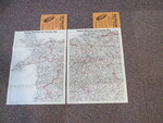
Author Dunlop Tyres Title Dunlop Touring Map of Great Britain and Ireland Scale 4 miles to 1 inch, No.6 (Anglesey and NW West Wales) and No. 7 (Cheshire, Shropshirer and NE Wales) Price £25.00 Full Details
Add this to your basketRef:4119 
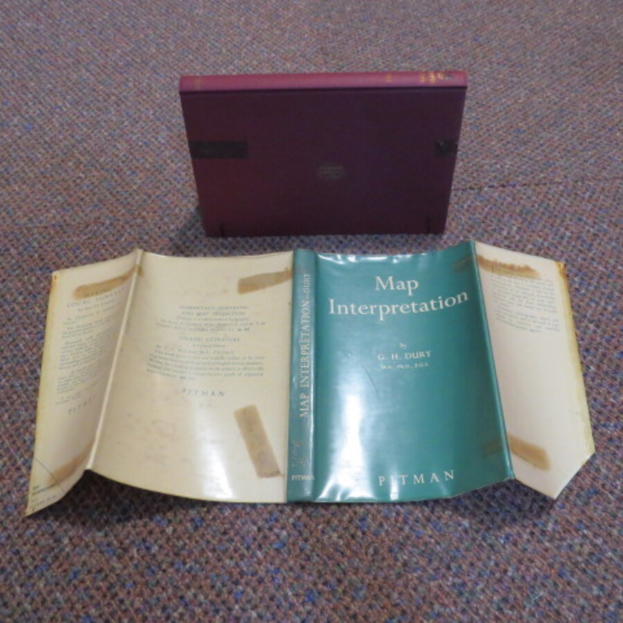
Author Dury, G. H.; Moodie, A. E. (foreword); Brookfield, H. C. (contribution) Title Map Interpretation Price £4.00 Full Details
Add this to your basketRef:3996 
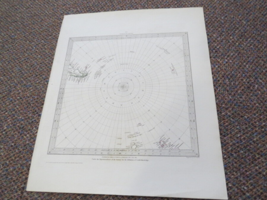
Author Engraved by Walker, J & C. Title Circumjacent the South Pole No. 6 Map 1831. (World on gnomonic projection VI. From South Pole to 45 degrees South Latitude). Price £150.00 Full Details
Add this to your basketRef:4051 
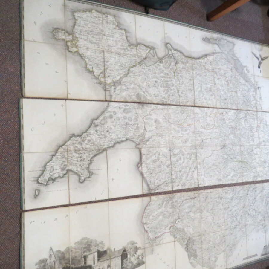
Author Evans, John (Engraved by Robert Baugh) Title [Large Map on Linen of North Wales] To Sir Watkin Williams-Wynn Bart. LLD, Member Of Parliament, Lord Lieutenant And Custos Rotulorum Of The Counties Of Denbigh.... This Map Of The Six Counties Of North-Wales..Scale: 3/4 inch to one statute mile Price £3750.00 Full Details
Add this to your basketRef:3985 
Author Gage, Michael Alexander (Thomas Starling, Engraver) Title This Trigometrical Plan of The Town and Port of Liverpool, including the Environs of Edgehill and Toxteth Park, Kirkdale Everton Low Hill from Actual Survey Price £1100.00 Full Details
Add this to your basketRef:3961 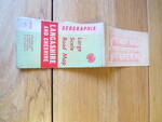
Author Geographia Title "Geographia" Large Scale Road Map of Lancashire and Cheshire showing new & projected by-pass roads & Motorways Price £5.00 Full Details
Add this to your basketRef:4111 
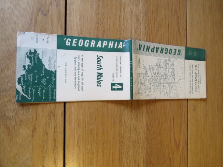
Author Geographia Title "Geographia" Large Scale Road Map of South Wales showing new & projected by-pass roads & Motorways. Clearway mileage map. Sheet 4 Price £5.00 Full Details
Add this to your basketRef:4116 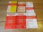
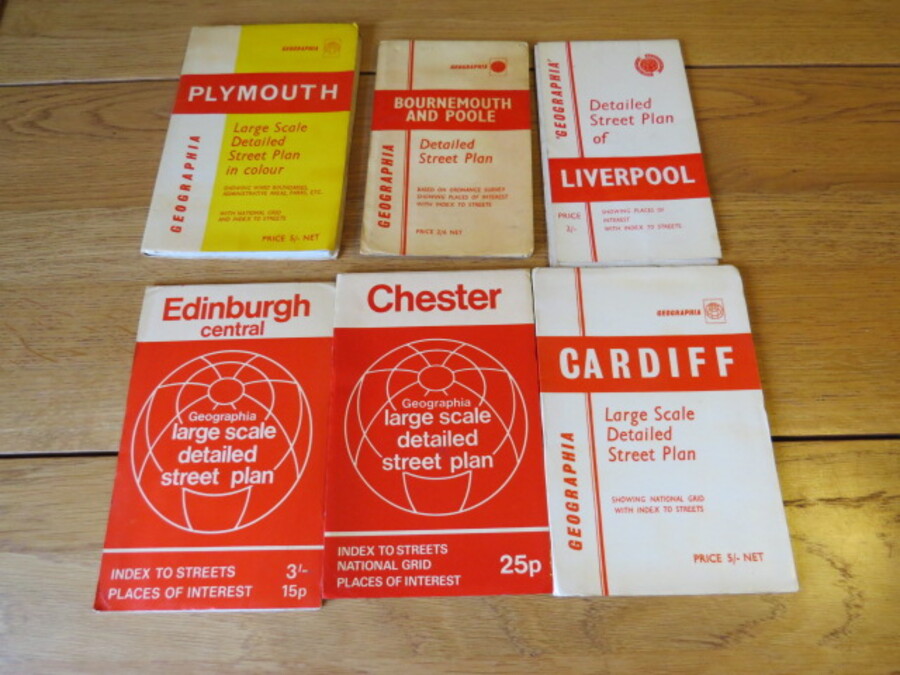
Author Geographia Title 6 x "Geographia" Large Scale and Detailed Street Plans based on Ordnance Survey. (Bournemouth and Poole; Cardiff; Chester; Edinburgh Central; Liverpool; Plymouth) Price £12.00 Full Details
Add this to your basketRef:4117 
Author George Philipp & Son Title Daily Express New Road Book of Great Britain Price £5.00 Full Details
Add this to your basketRef:4004 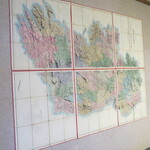
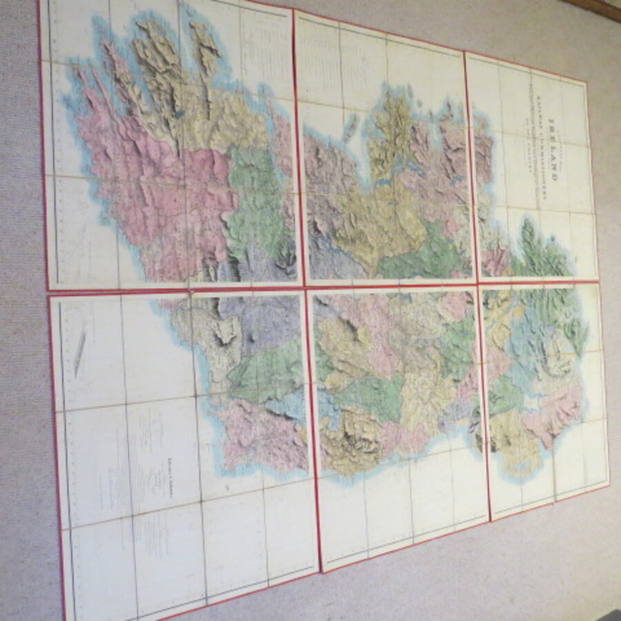
Author Griffith, Richard John, Sir Title A General Map of Ireland to Accompany the Report of the Railway Commissioners shewing the principal and physical features and geological structure of the Country. Also shows railway lines, place names, soundings, offshore currents. etc., Price £6500.00 Full Details
Add this to your basketRef:3987 
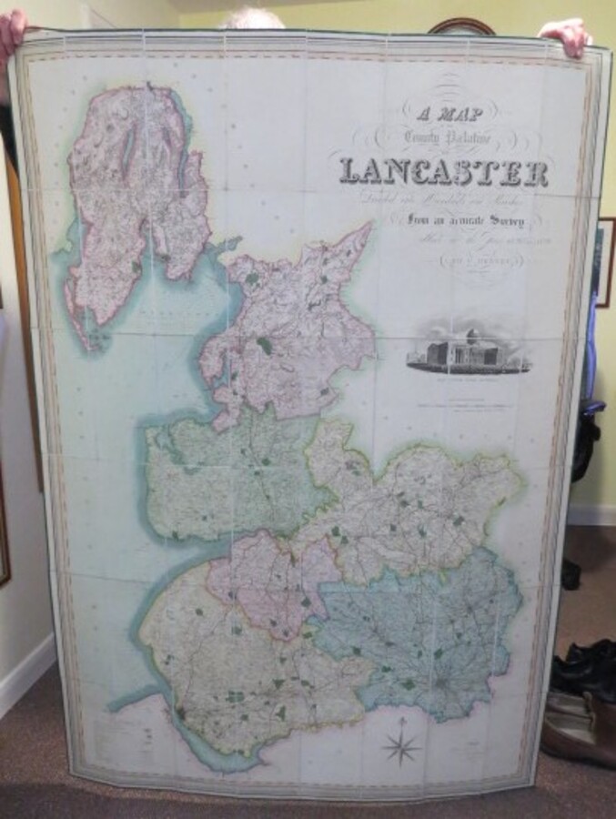
Author Henry Teesdale (Hennet, George Surveyor) (James Bingley, Engraver) Title A Map of the County Palatine of Lancaster Divided into Hundreds and Parishes from an accurate Survey made in the Years 1828 and 1829. Price £600.00 Full Details
Add this to your basketRef:3958 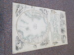
Author Hugh-Johnson, J F.R.G.S. (Fullarton, A . Engraved by) Title The Arctic Regions Showing the North-West Passage as Determined by Cap.R.Mc Clure and other Arctic Voyagers. Wellington Channel, Melville Island Price £110.00 Full Details
Add this to your basketRef:4050 
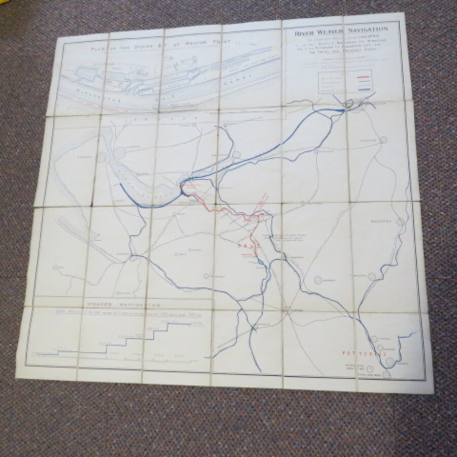
Author Hughes, T.B. General Manager and Saner, J.A. Engineer Title Northwich and Winsford and to the Potteries Via Anderton Lift and the Trent and Mersey Canal' Price £75.00 Full Details
Add this to your basketRef:3962 
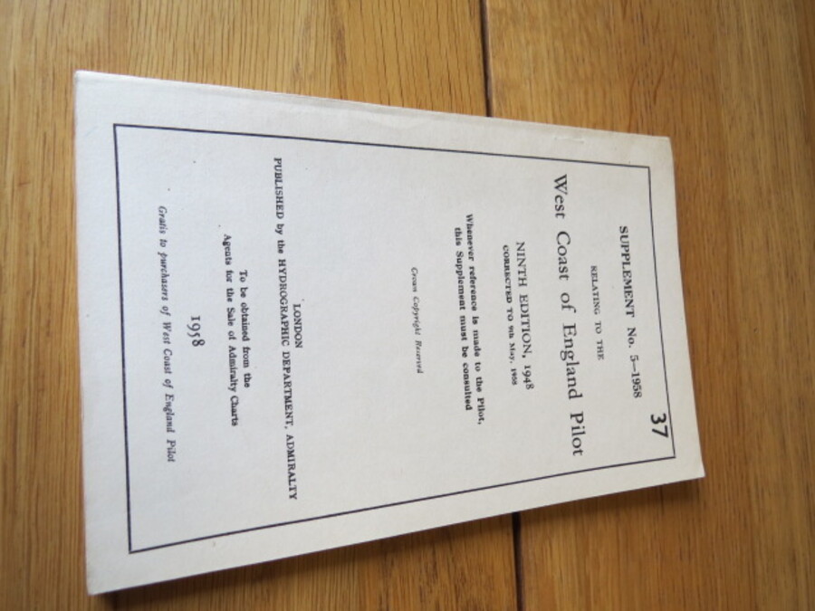
Author Hydrographic Department, Admiralty Title Supplement No.5-1958 Relating to the West Coast of England Pilot Price £5.00 Full Details
Add this to your basketRef:4078 
Author Introduction by Cary Tristam. (Editors; Richard Atkinson, Philip Parker, Ian Harrison) Title England The Photographic Atlas Price £135.00 Full Details
Add this to your basketRef:4043 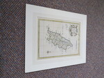
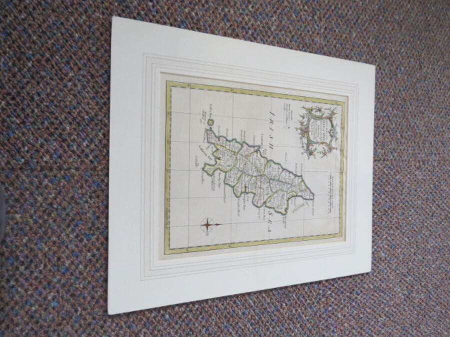
Author Kitchin, Thomas Title A NEW MAP OF THE ISLE OF MAN: Drawn from the Best Authorities by Tho.Kitchin Geogr Engraver to H.R.H. the Duke of York. Price £50.00 Full Details
Add this to your basketRef:4047 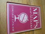
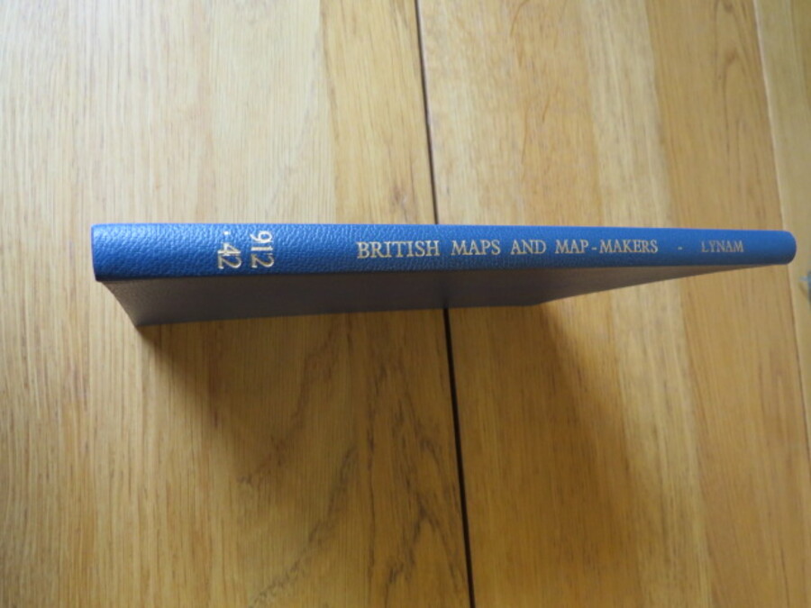
Author Lynam, Edward Title British Maps and Map-Makers: Britain in Pictures Series Price £5.00 Full Details
Add this to your basketRef:4083 
Author Lynam, Edward Title British Maps and Map-Makers: Britain in Pictures Series. Third Impression, Revised. Price £5.00 Full Details
Add this to your basketRef:4084 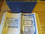
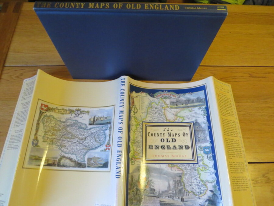
Author Moule, Thomas (Introduction by Barron, R) Title The County Maps of Old England Price £10.00 Full Details
Add this to your basketRef:4091 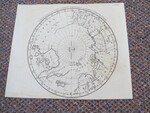
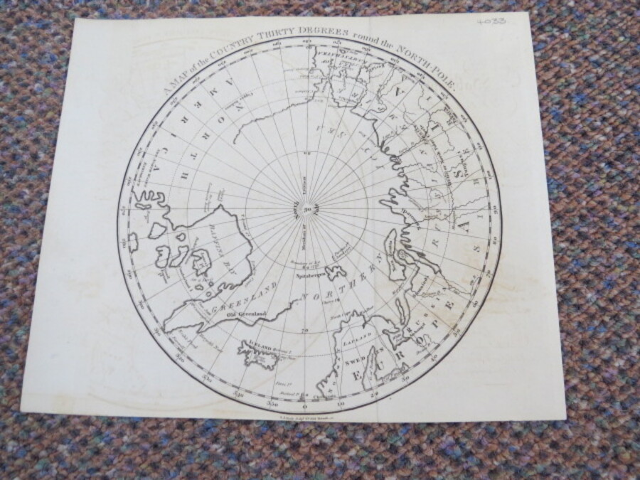
Author Neele, Samuel John. Title A Map of the Country Thirty Degrees Round the North-Pole. Price £75.00 Full Details
Add this to your basketRef:4033 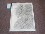
Author Ordnance Map Office (Col. Colby) and Edward Stanford, London: Title Ordnance Survey Map 1837/74: Dolgelley & Barmouth Price £40.00 Full Details
Add this to your basketRef:3675 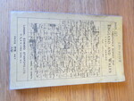
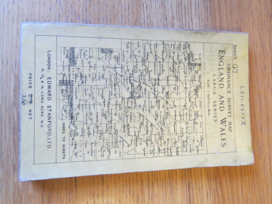
Author Ordnance Map Office and Edward Stanford, London. Title Ordnance Survey Map England and Wales. 1 inch to a mile. Large Series Sheet 63 (Map of area of Leicester) Price £10.00 Full Details
Add this to your basketRef:4104 
Author Ordnance Survey Title 3 maps: Denbigh & Colwyn Bay 1:50 000 First Series Sheet 116, Denbigh Sheet 108 One-Inch Map, Snowdon Sheet 107 One-inch map Price £5.00 Full Details
Add this to your basketRef:3411 
Author Ordnance Survey Title Ordnance Survey Map showing the town of Conwy and the Environs. Photozincograph Six inches to One mile. Price £75.00 Full Details
Add this to your basketRef:3966 
Author Ordnance Survey Title Ordnance Survey Map of Carnarvonshire and Part of Anglesey and Merionith Third Edition. One Inch to One mile 1:63,000 Price £100.00 Full Details
Add this to your basketRef:3965 
Author Ordnance Survey Title Ordnance Survey Great Britain County Series. Scale 1:10560 Six inches to One mile. Folding Maps Carnarvonshire 24 Map Set Price £400.00 Full Details
Add this to your basketRef:3971 
Author Ordnance Survey Title Ordnance Survey Great Britain County Series. Scale 1:10560 Six inches to One mile. Folding Maps Carnarvonshire 24 Map Set Price £300.00 Full Details
Add this to your basketRef:3981 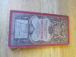
Author Ordnance Survey Title Ordnance Survey One-Inch Map of Aberystwyth and District. Coloured Edition: Sheet 69 Price £10.00 Full Details
Add this to your basketRef:4093 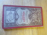
Author Ordnance Survey Title Ordnance Survey One-Inch Map of Anglesey and District. Coloured Edition: Sheet 40 Price £10.00 Full Details
Add this to your basketRef:4092 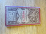
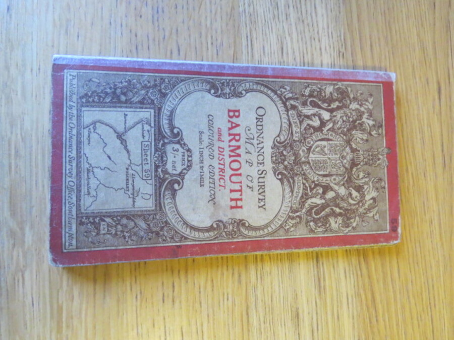
Author Ordnance Survey Title Ordnance Survey One-Inch Map of Barmouth and District. Coloured Edition: Sheet 59 Price £5.00 Full Details
Add this to your basketRef:4094 
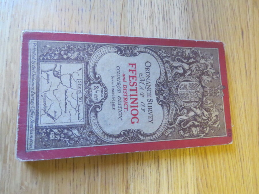
Author Ordnance Survey Title Ordnance Survey One-Inch Map of Ffestiniog and District. Coloured Edition: Sheet 50 Price £10.00 Full Details
Add this to your basketRef:4095 
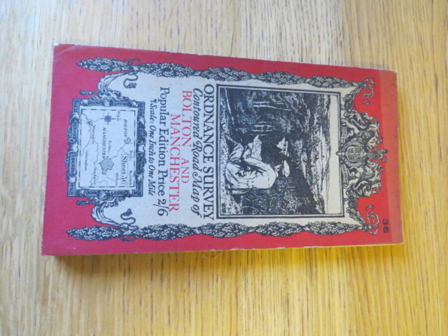
Author Ordnance Survey Title Ordnance Survey Contoured Road Map of Bolton and Manchester: One Inch Popular Edition, Sheet 36 Price £20.00 Full Details
Add this to your basketRef:4100 
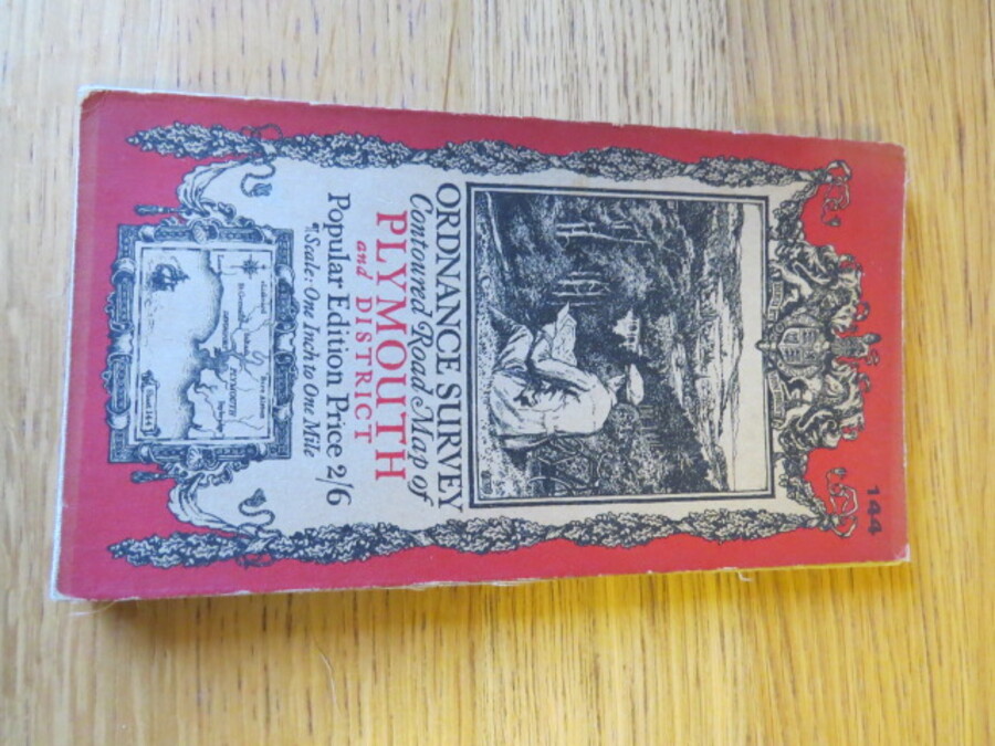
Author Ordnance Survey Title Ordnance Survey Contoured Road Map of Plymouth and District: One Inch Popular Edition, Sheet144 Price £15.00 Full Details
Add this to your basketRef:4097 
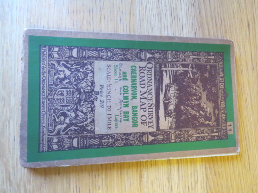
Author Ordnance Survey Title Ordnance Survey Road Map of Caernarvon, Bangor and Colwyn Bay. Sheet 11. Layered Edition. Scale Half-Inch Inch to One Mile Price £20.00 Full Details
Add this to your basketRef:4101 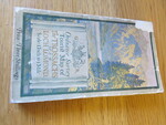
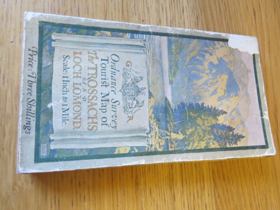
Author Ordnance Survey Title Ordnance Survey Tourist Map of The Trossachs and Loch Lomond: 1 inch to 1 mile. Cloth Map Price £10.00 Full Details
Add this to your basketRef:4103 
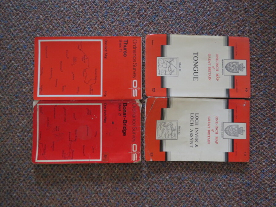
Author Ordnance Survey Title Ordnance Survey Folding Paper Maps, Scotland x 4 Maps (Sheet 10 Tongue, Sheet 21 Bonar-Bridge, Sheet 11 Thurso, Sheet 13 Loch Inver & Loch Assynt) One inch, One-inch Price £5.00 Full Details
Add this to your basketRef:4114 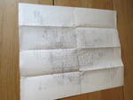
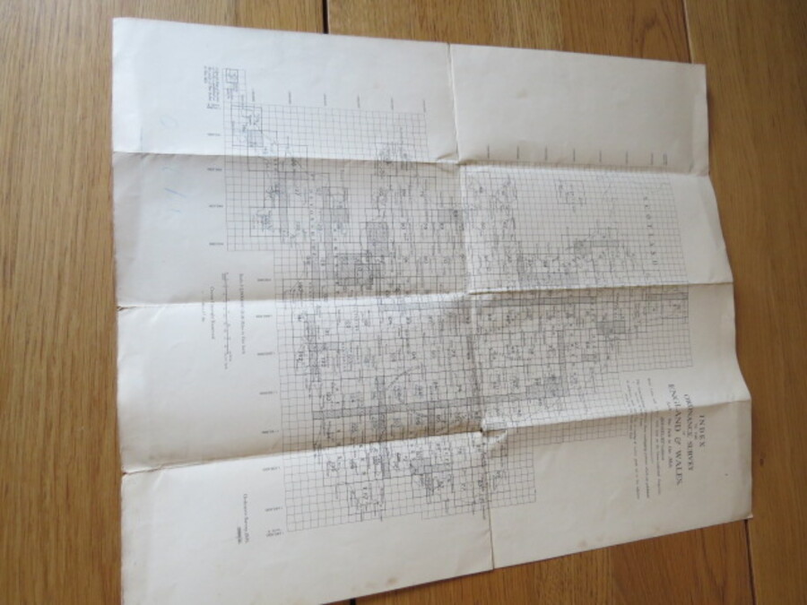
Author Ordnance Survey Title Index Sheet to the Ordnance Survey of England and Wales. Scale: One Inch to One Mile, fifth (Relief) Edition. Price £20.00 Full Details
Add this to your basketRef:4118 
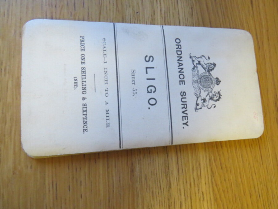
Author Ordnance Survey Title Ordnance Survey of Ireland One Inch Map of Sligo, Ireland. Sheet 55 Price £15.00 Full Details
Add this to your basketRef:4123 
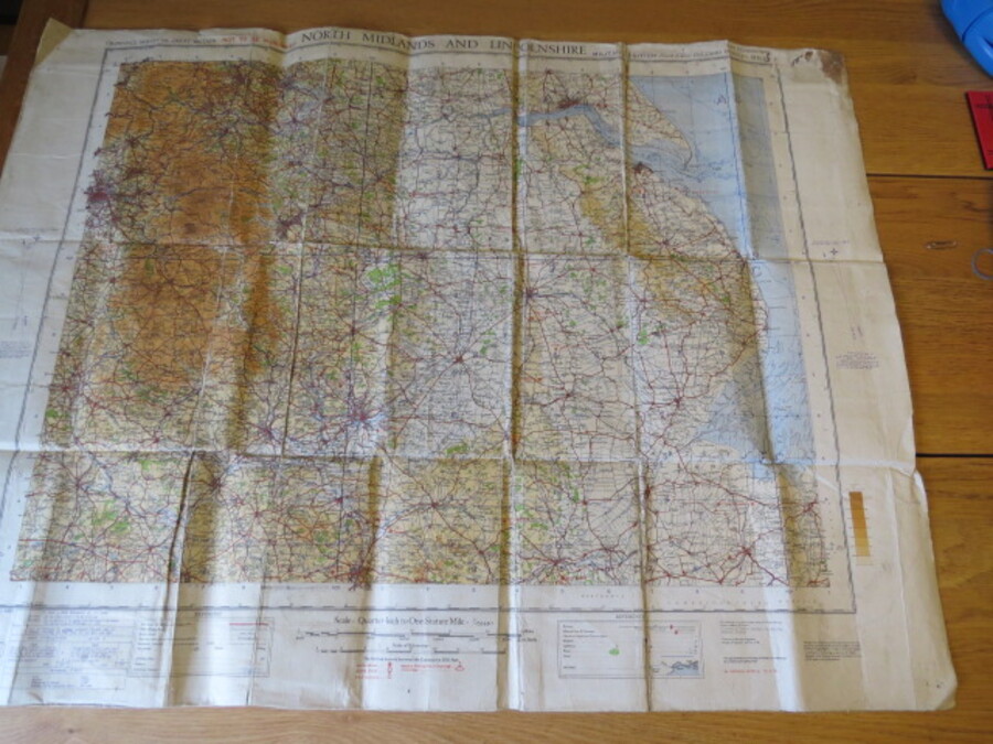
Author Ordnance Survey of Great Britain Title Ordnance Survey North Midlands and Lincolnshire. Sheet 6; Quarter-Inch Map, Fourth Edition, Military Edition, War Revision 1940 Price £5.00 Full Details
Add this to your basketRef:4115 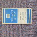
Author Ordnance Survey, Director General. Title Ordnance Survey, 1:25,000 map of Great Britain SD Series 62 Blackburn Price £5.00 Full Details
Add this to your basketRef:3972 
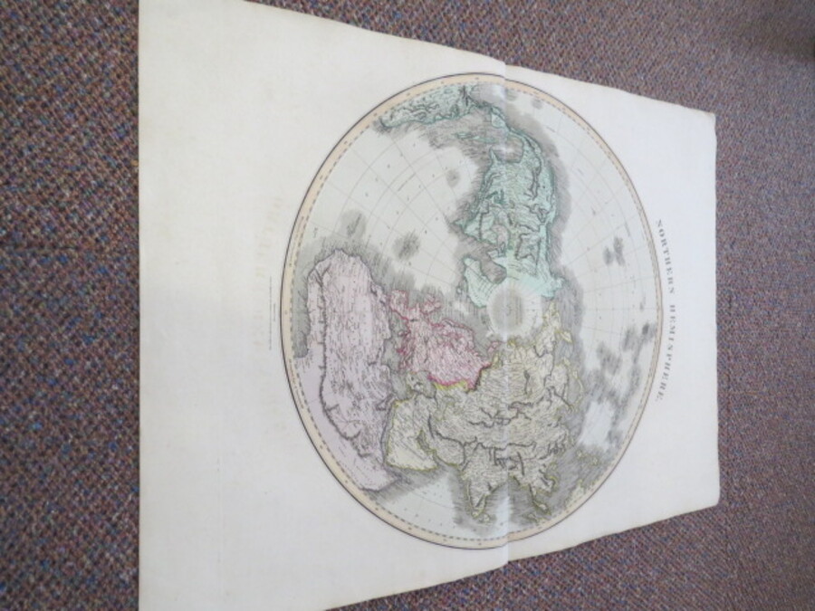
Author Philip, George & Son (Published by) Title Northern Hemisphere, projected on the plane of the horizon of London Price £125.00 Full Details
Add this to your basketRef:4054 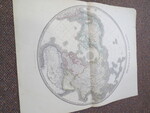
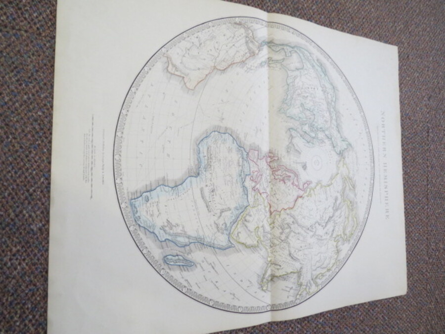
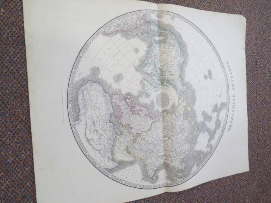
Author Philip, George & Son (Published by) Title Northern Hemisphere Price £140.00 Full Details
Add this to your basketRef:4060 
Author Porter Prints (Durham, Tho) Title Old Map of the Isle of Man Ano. 1595 (No. 371 ) Authentic Replica on Antiqued Parchment Price £5.00 Full Details
Add this to your basketRef:4127 
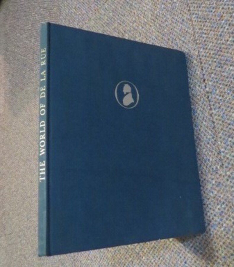
Author Rosner, Charles (Editor) Title The World Of De La Rue. The Old World And The New Presented On The Occasion Of The One Hundred and Fiftieth Anniversary Of The House Of De La Rue 1813 - 1963. Price £5.00 Full Details
Add this to your basketRef:3989 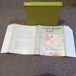
Author Skelton, R A Title Explorers' Maps: Chapters in the Cartographic Record of Geographical Discovery. Price £25.00 Full Details
Add this to your basketRef:3995 
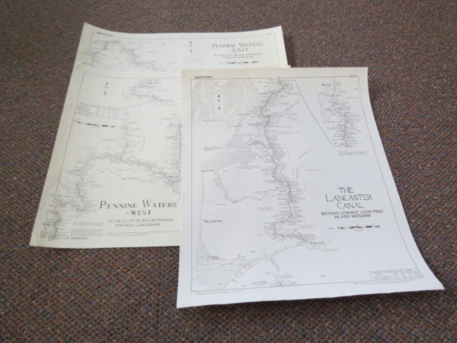
Author Smith, Douglas M., Title Set of 3 Lockmaster Maps: No.27-The Lancaster Canal, Nos. 2&3 Penine Waters West and East Price £15.00 Full Details
Add this to your basketRef:4046 
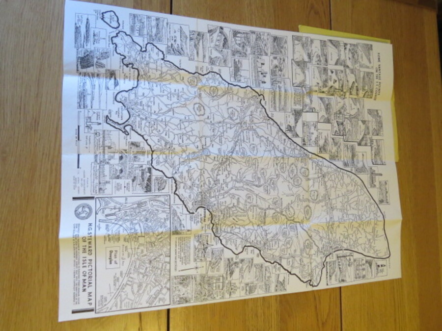
Author Steward, H.G. Title Large Scale Pictorial Map of the Isle of Man Showing T.T. Course and vantage points, roads, railways, towns, villages, etc., and street plan of Douglas. 70 illustrations of some of the many places of interest throughout the island Price £40.00 Full Details
Add this to your basketRef:4125 
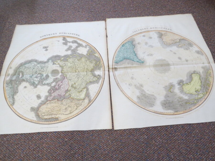
Author Thomson, J Title Northern Hemisphere and Southern Hemisphere Maps Price £300.00 Full Details
Add this to your basketRef:4055 
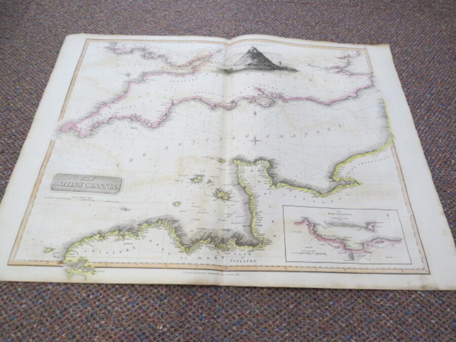
Author Thomson, J Title The British Channel with The Breakwater of Cherbourg and Engraving of St. Michael's Mount. Price £75.00 Full Details
Add this to your basketRef:4061 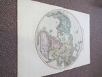
Author Thomson, J (Kirkwood Sculp.) Title Northern Hemisphere. Price £200.00 Full Details
Add this to your basketRef:4058 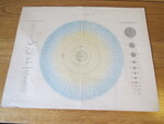
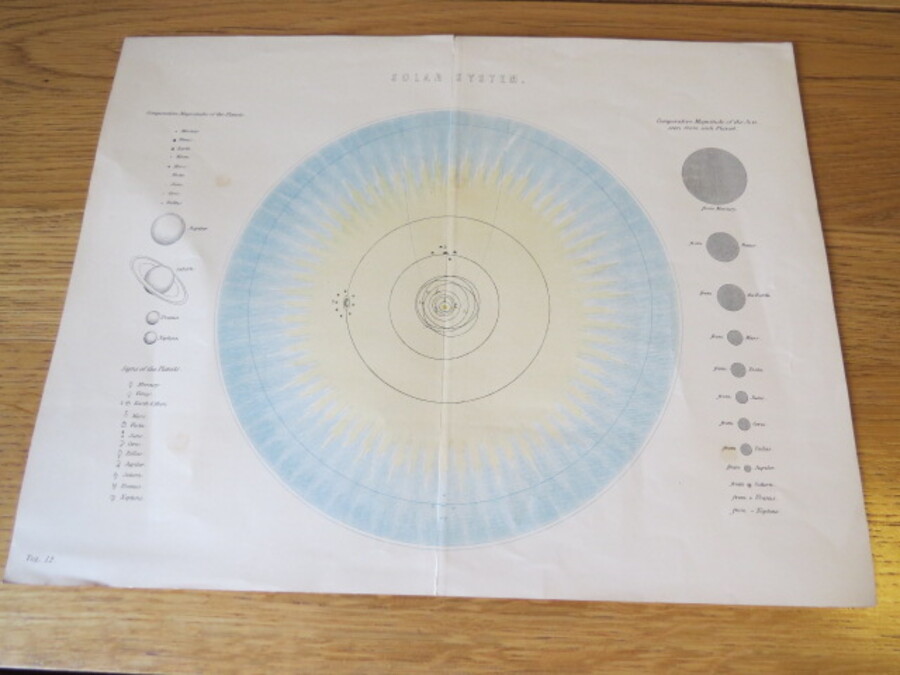
Author Unknown Title Solar System Astronomical Chart Price £20.00 Full Details
Add this to your basketRef:4070 
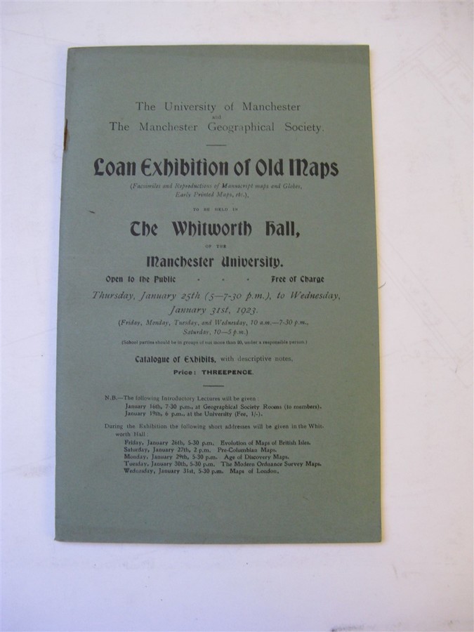
Author Various Title LOAN EXHIBITION OF OLD MAPS, WHITWORTH HALL January 25th - 31st 1923 Catalogue of Exhibits with descriptive notes. Price £2.50 Full Details
Add this to your basketRef:2567 
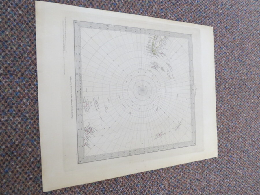
Author Walker, J & C (Engraved by) Title Circumjacent the South Pole No. 6 Map No date 1841-1842 Price £80.00 Full Details
Add this to your basketRef:4026 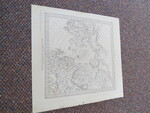
Author Walker, J & C (Engraved by) Title Circumjacent the North Pole No. 5 Map Price £90.00 Full Details
Add this to your basketRef:4034 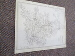
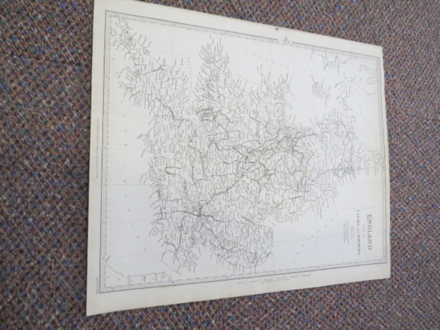
Author Walker, J & C. (Engraved by) Title England With the Canals and Railways Map. Published under the Superintendence of Society for the Diffusion of Useful Knowledge Price £40.00 Full Details
Add this to your basketRef:4052 
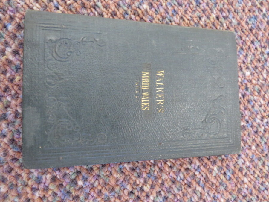
Author Walker, J.& C. Title WALKER'S NORTH WALES (WALKER'S COUNTY MAPS SERIES) Price £25.00 Full Details
Add this to your basketRef:3677 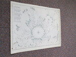
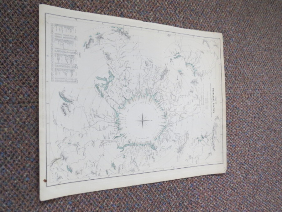
Author Walker, J.C. (Engraved by) Title A Map of the Principal Rivers Shewing Their Courses, Countries and Comparative Lengths. Price £90.00 Full Details
Add this to your basketRef:4049 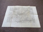
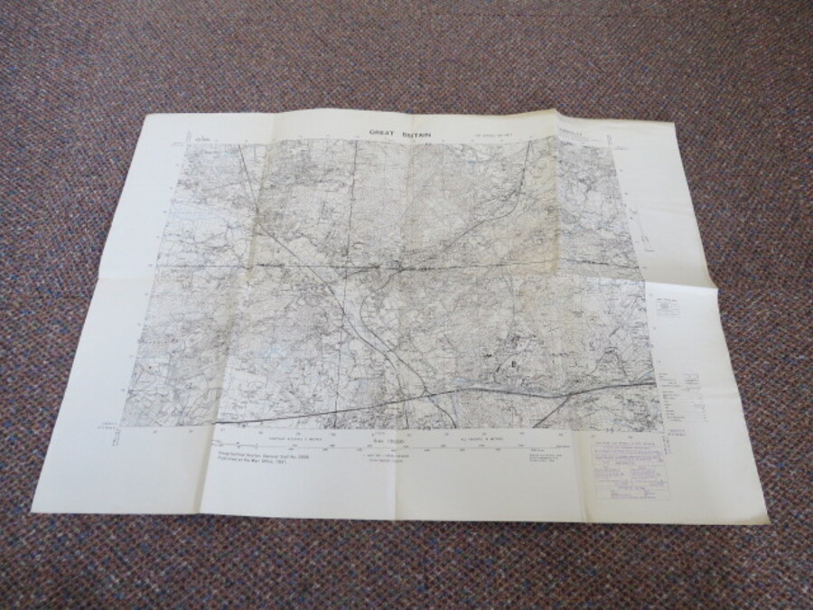
Author War Office, For Official Use Only Title Great Britain Scale 1:25,000 Map of Great Britain Geographical Section, General Staff Number 3906: CAMBERLEY Parts of 50/18 S.E, 50/16 N.E. & 53/18 S.W. 53/16 N.W. Price £30.00 Full Details
Add this to your basketRef:4035 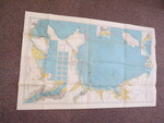
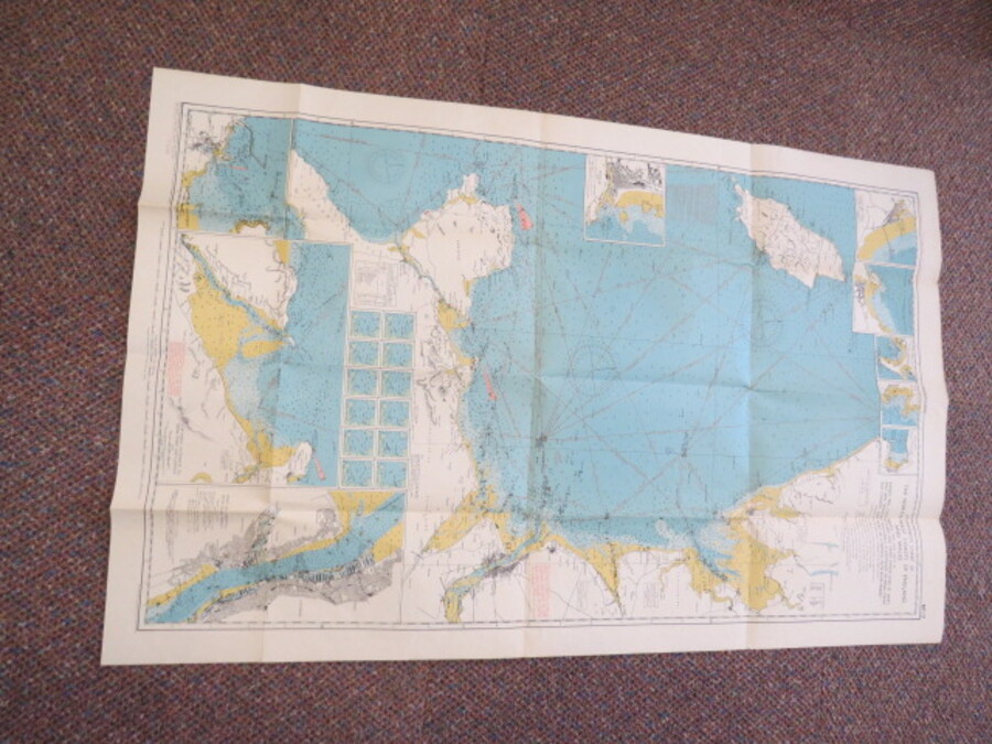
Author Watts, O.M. Captain (Edited by) Title Stanford's Coloured Charts for Coastal Navigators No.17 The North-West Coast of England and Wales. Officially approved by the Y.M.B.A. Price £15.00 Full Details
Add this to your basketRef:4081 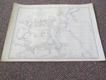
Author Weller, Edward. F.R.G.S. (Engraved by) Title The Arctic Regions of North America. Price £30.00 Full Details
Add this to your basketRef:4045 
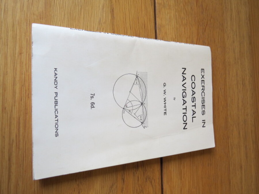
Author White, G.W. Title Exercises in Coastal Navigation Price £5.00 Full Details
Add this to your basketRef:4075 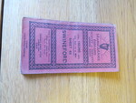
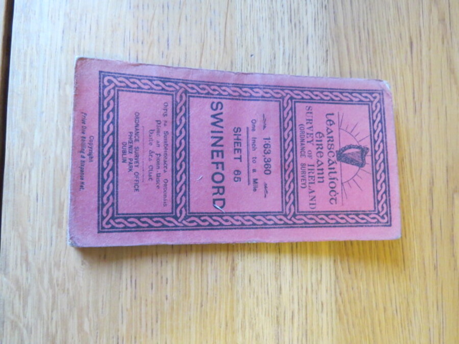
Author Wilkinson, B.E. Capt (Engraved at the Ordnance Survey Office Dublin under the direction of) Title Learscailioct Eireann Survey of Ireland (Ordnance Survey) 1:63,360 One inch to a mile, Sheet 65, Swineford, Ireland. Price £15.00 Full Details
Add this to your basketRef:4110 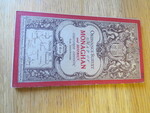
Author Wilkinson, B.E. Capt (Engraved at the Ordnance Survey Office Dublin under the supervision of) Title Ordnance Survey One Inch Map of Monaghan and District, Ireland. Coloured Edition: Sheet 58. Price £15.00 Full Details
Add this to your basketRef:4096 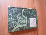
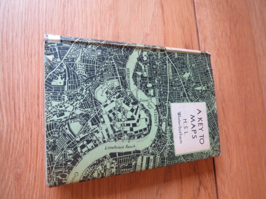
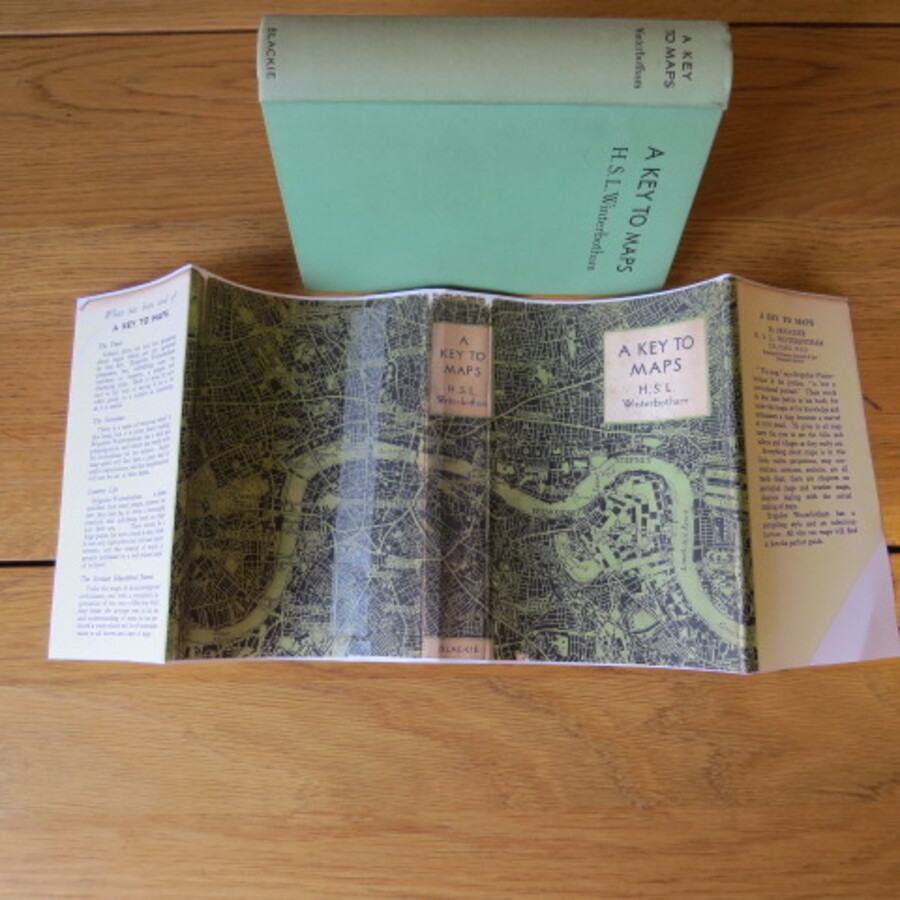
Author Winterbottom, Brigadier H.S.L Title A Key to Maps Price £10.00 Full Details
Add this to your basketRef:4085 
Author Winterbottom, Brigadier H.S.L Title A Key to Maps Price £12.50 Full Details Ref:4087