Polar Books Catalogue
-
Sections : Antarctic; Arctic; Journal of the Manchester Geographical Society; Maps; Miscellaneous; Mountaineering; General Polar; Scott; Other travel; Whaling;
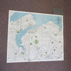
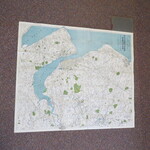
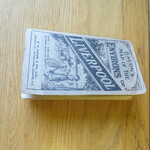
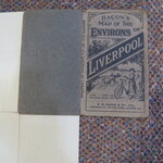
Reference 3970 (2193) Category Maps; Author Bacon Title BACON'S CYCLING AND MOTORING MAP OF LIVERPOOL DISTRICT One Inch to the Mile. Publishing Information London: G.W. Bacon & Co., Ltd., circa 1900s Description Undated circa 1890s. Coloured map 760 x 660 mm, includes Southport (to the north), Wigan and Warrington (to the East) and extends about two miles south of the Mersey. Main roads in yellow, parks in green, includes canals and railways. Scale 1 Inch to a mile, altitudes above sea level shown in feet. Folds to 170 x 100 mm. Price 1/s 6d. net (the cloth version was 2s6d.net) Map has been extensively but neatly repaired in the past with repairs strengthening to most folds, few splits but no significant loss. Covers clean but worn. Price £15.00 Keywords ISBN Add this to your basket
