Polar Books Catalogue
-
Sections : Antarctic; Arctic; Journal of the Manchester Geographical Society; Maps; Miscellaneous; Mountaineering; General Polar; Scott; Other travel; Whaling;
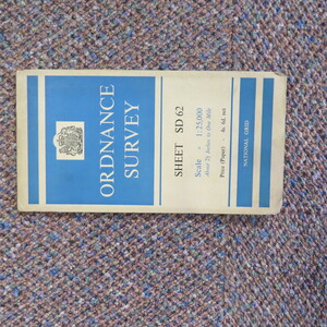

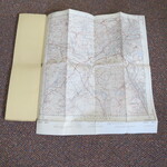
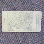
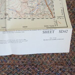
Reference 3972 (2194) Category Maps; Author Ordnance Survey, Director General. Title Ordnance Survey, 1:25,000 map of Great Britain SD Series 62 Blackburn Publishing Information Surrey: Director General of Ordnance Survey,1959 Description Folding paper map. SD62, 44cmx44cm square, folding into 23cmx12cm. This map is the 1959 reprint of the 1955 issue with minor corrections. The 1:25,000 'Provisional edition' or 'First Series', was Ordnance Survey's first civilian map series at this medium scale, the forerunner of the modern Explorer and Outdoor Leisure maps. By 1956 it covered 80% of Great Britain, everywhere apart from the Scottish Highlands and Islands. The series is useful for showing rural and urban areas in much greater detail than the standard one-inch to the mile (1:63,360) maps. Good clean condition. Price £5.00 Keywords ISBN Add this to your basket
