Polar Books Catalogue
-
Sections : Antarctic; Arctic; Journal of the Manchester Geographical Society; Maps; Miscellaneous; Mountaineering; General Polar; Scott; Other travel; Whaling;

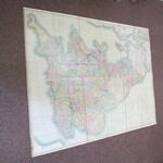
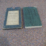
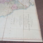
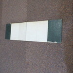
Reference 3968 (2198) Category Maps; Author Cary, J Title CARY'S NEW SIX SHEET MAP OF ENGLAND AND WALES WITH PART OF SCOTLAND. Publishing Information London: J. Cary, No.86 St. James St, 1826 Description CARY'S SIX SHEET MAP OF ENGLAND AND WALES WITH PART OF SCOTLAND On which are carefully laid down all the direct and principal cross roads, the course of the rivers and navigable canals, Cities, Market and Borough Towns, Principal Villages, Parks &c. Compliled from the most recent surveys 1826. Complete map in slip case, 1035mm x 1340mm. Scale: British Statue Mile 69 and a half to a degree; Geographical miles 60 to a degree. Previous owners signature (Mr James Aspinall) and address on marbled boards and on map label on slip case.Originally a 6-part map of England and Wales, it has been expertly dissected and linen-backed, as one large map, map dimensions 1035mm x 1340mm. Price £900.00 Keywords ISBN Add this to your basket
