Polar Books Catalogue
-
Sections : Antarctic; Arctic; Journal of the Manchester Geographical Society; Maps; Miscellaneous; Mountaineering; General Polar; Scott; Other travel; Whaling;
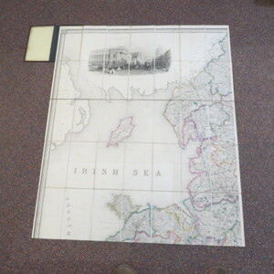
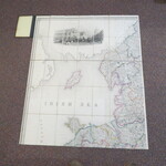
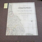
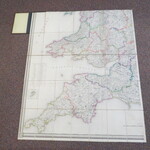
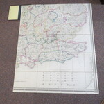
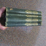
Reference 3967 (2199) Category Maps; Author Creighton, R. (Engraver J. Dower) Title Lewis's A Map of England and Wales Divided Into Counties, Parliamentary Divisions and Dioceses Shewing the Principal Roads, Railways, Rivers and Canals Publishing Information London: S. Lewis & Co., circa 1846-1854 Description Full Title: Map of England & Wales Divided into Counties, Parliamentary Divisions and Dioceses. Shewing the Principal Roads, Railways, Rivers & Canals and the seats of the Nobility and Gentry. With the distance of each town from the General Post Office, London. Projected from the triangulation for the survey made under the Direction of the honorable The Board of Ordnance on a scale of five miles to an inch and corrected to the present time Drawn by R. Creighton, Engraved by J. Dower. Complete set of four maps in original bindings, mounted in sections on linen. Green cloth boards with gilt detailing and gilt titles to spines. An updated edition revised to include the development and growth of the railways in the early Victorian period. Each map is hand-coloured on folding linen, size 106cm by 90 cm, and each in 35 sections. A key provides information on cities, market towns, parishes and other townships, hamlets, rivers, gentlemen's seats, churches (and these are shown in 3 different categories), parks, mail roads, turnpike roads, canals, rail roads, mountains and various administrative divisions. A panel beneath the map with a series of crests gives details of the 20 dioceses in the province of Canterbury and the 5 in the province of York. The North-West sheet has a large engraving of the London Post Office and the North-East sheet a decorative compass rose beneath the title and key. Folds into original boards with decorated borders. All 4 maps are in good condition , the covers show shelf wear and some loss or rubbing to extremities, a small piece of leather is worn on the front cover of the NE map. An updated edition revised to include the development and growth of the railways in the early Victorian period. Dating is difficult as there is no railway shown to Penzance, with the line stopping at Plymouth (Royal Albert Bridge completed in 1859) but the railways along the North West appear almost complete. The amount of proposed railways suggests a date of around 1847 to 1850. Price £320.00 Keywords ISBN Add this to your basket
