Polar Books Catalogue
-
Sections : Antarctic; Arctic; Journal of the Manchester Geographical Society; Maps; Miscellaneous; Mountaineering; General Polar; Scott; Other travel; Whaling;
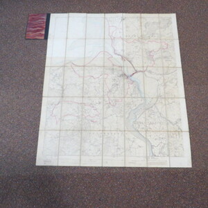

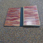
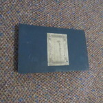
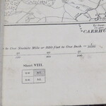
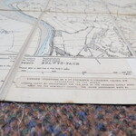
Reference 3966 (2200) Category Maps; Author Ordnance Survey Title Ordnance Survey Map showing the town of Conwy and the Environs. Photozincograph Six inches to One mile. Publishing Information Southampton: Ordnance Survey, 1890 Description Ordnance Survey, 1890. Mounted in sections (35) on cloth and folded in marbled hard covered book with Stanford label. Map measures 790mm x 920mm. Previous owners name and date January 1903 on the label. This map appears to be a composite of the various OS maps of the time, dissected and laid on linen to cover s specific area. There are parts of OS Maps IX-NW, V-SW, IV-SE,IV-NW,V-NW, VIII-NE. The area covered goes are far West as Dwygyfylchi, East to Llangwesten, North to Llundudno station and South to Llangeliyni. Price £75.00 Keywords S1-Map ISBN Add this to your basket
