Polar Books Catalogue
-
Sections : Antarctic; Arctic; Journal of the Manchester Geographical Society; Maps; Miscellaneous; Mountaineering; General Polar; Scott; Other travel; Whaling;

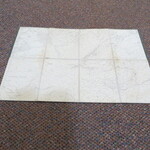
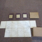
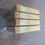
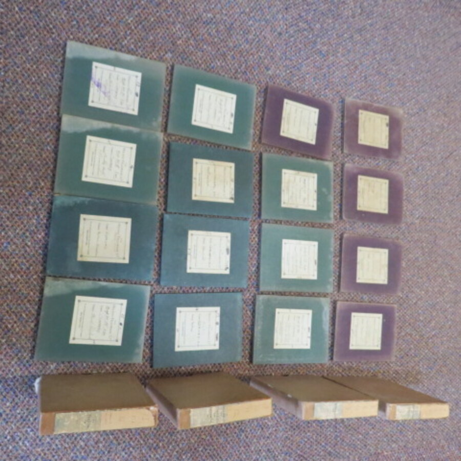
Reference 3981 (2224) Category Maps; Author Ordnance Survey Title Ordnance Survey Great Britain County Series. Scale 1:10560 Six inches to One mile. Folding Maps Carnarvonshire 24 Map Set Publishing Information Ordnance Survey,1901 to 1914. Description Various Editions 1901 to 1914: Ordnance Survey 1:10560 / six-inch to one mile plus 1 map 1 inch to the mile. Set of 24 maps in 6 slip cases. Each folding map is dissected into 8 sections and laid on linen, 4 per slip case. [16x12cm] with paper label. Set of 23 sheets covering the County of Carnarvonshire, (as was) in Wales. 1887,1874 - revised in 1899. Each map approx. 36cmx41cm . They have been cut in a way that the keys are missing but they all would neatly join together and I suspect various sets would have been taken on various walking or surveying trips in the area. Sheets: Carnarvonshire IV SE, VIII NE, VIII SE, XIII NE, XIII SE, XVIII NE, XVIII SE, XXIII NE, XXIII SE, XIV SW, XIX NW, XIX SW, XXIV NW, XXIV SW, XXIII NW, The final map is a one inch to one mile scale and covers Mid Wales, with parts of OS Maps 119 Snowdon,120 Corwen,135 Harlech and 136 Bala, this map is in colour, 72cm x 48cm, it is laid on linen and dissected into 18 sections and matches the size of the other maps when folded, the magnetic variation is dated 1912. This map is stamped Morfa Camp. The maps have pencil annotations, such as map number, Latitude and Longitude markings, the odd additional path marked in red ink and odd note to the verso cover, the hard covers have labels attached, labelled The Holiday Fellowship Ltd., The linen also has a stamps "The Holiday Fellowship Ltd., Bryn Corach, Conway, N. Wales. The areas covered with the six inch scale includes Penmaenmawr, Conwy, Betws-y-Coed, Llyn Crafnant, Capel Curig, Swallow Falls, Trefriw. There is a book binders label "Bound by R.E. Jones and Brothers" on the odd map cover. The maps look like they have been used, there is some damp staining to the linen but are still in good condition. The Ordnance Survey Great Britain County Series maps were produced from the 1840s to the 1890s. The six-inch sheets covered an area of six by four miles on the ground; the twenty-five inch sheets an area of one by one and a half. One square inch on the twenty-five inch maps was roughly equal to an acre on the ground. In later editions the six-inch sheets were published in "quarters" (NW, NE, SW, SE), each covering an area of three by two miles on the ground. The first edition of the two scales was completed by the 1890s. A second edition (or "first revision") was begun in 1891 and completed just before the First World War. Price £300.00 Keywords ISBN Add this to your basket