Polar Books Catalogue
-
Sections : Antarctic; Arctic; Journal of the Manchester Geographical Society; Maps; Miscellaneous; Mountaineering; General Polar; Scott; Other travel; Whaling;
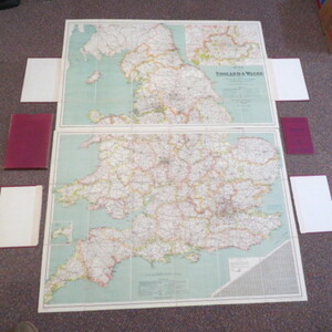

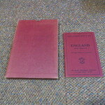
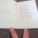
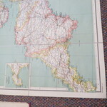
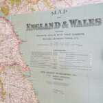
Reference 3986 (2227) Category Maps; Author Bacon, G. W. and Co Title Map of England and Wales, showing Railways, roads with their numbers, mileage between towns etc., complete with booklet Index and Route Guide with Useful Information for Motorists Publishing Information The Chart Publishing Company, G. W. Bacon and Co, circa1920s Description Bacon's Map of England & Wales showing Railways, Roads and Distances. 2 coloured maps, dissected and laid on linen. 2 maps, 98cm x 60cm and 100cm x 70 cm approx. Scale: 8 miles to one inch. Inset map showing "Main Roads out of London", Scale 2 miles to 1 and a quarter inches. Copyright L4079. One set of covers is detached but easily repairable. The maps are in very nice condition. Slip case worn. The accompanying 64 page booklet is in very good condition. The Ministry of Transport is mentioned in the 'explanation' in the information in the booklet and this was formed after the first world war in 1919. Price £45.00 Keywords ISBN Add this to your basket
