Polar Books Catalogue
-
Sections : Antarctic; Arctic; Journal of the Manchester Geographical Society; Maps; Miscellaneous; Mountaineering; General Polar; Scott; Other travel; Whaling;
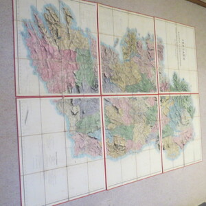
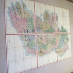
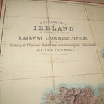
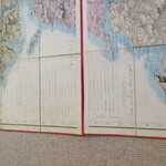
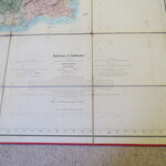
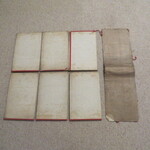
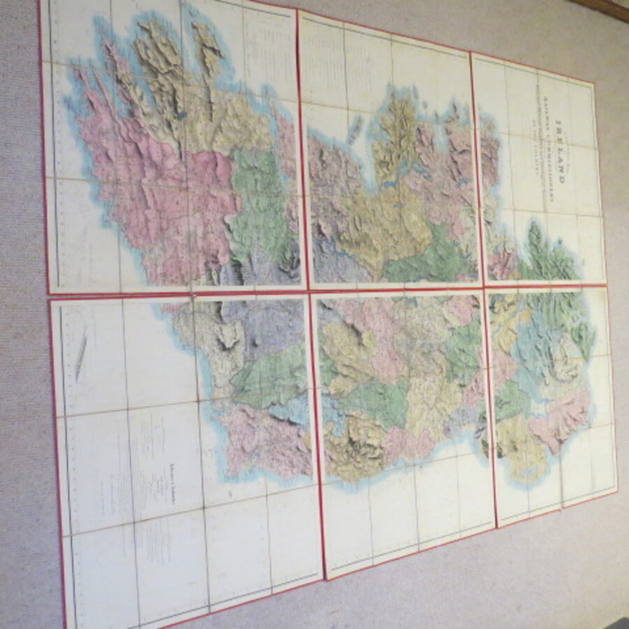
Reference 3987 (2242) Category Maps; Author Griffith, Richard John, Sir Title A General Map of Ireland to Accompany the Report of the Railway Commissioners shewing the principal and physical features and geological structure of the Country. Also shows railway lines, place names, soundings, offshore currents. etc., Publishing Information Published and Sold by Hodges and Smith, Dublin and James Gardner, London, 1838 (1841) Description A good example of the first large scale folding engraved wall map of Ireland, in 6 sheets (each sheet approx. 60cmx74cm) dissected and laid on cartographic linen, divided into 12 sections.(each section folds into approx 26cmx17cm) Overall size approx.150cm x 185cm. Scale 1:253,440. 1 inch to 4 Statute Miles. Each sheet is initialled and dated by the engraver in lower right hand margin, conceivably by 'RG'. The dates read August 1st 1841. The handwriting seems similar to Griffiths' as it appears in his dated signature at the bottom of the Key. Full Title: A General Map of Ireland to Accompany the Report of the Railway of the Railway Commissioners shewing the principal and physical features and geological structure of the Country. Constructed in 1836 and engraved in 1837-38. Published and Sold by Hodges and Smith, Dublin and James Gardner, London with whom copies coloured geologically are deposited. Price 20/- plain. The linen is grubby and each map has the compass region in ink. The maps are clean and bright. The six sections have a very grubby sheet of cartographic linen encasing them. NOTES: Published in 6 separate sheets available flat or dissected on linen. These maps were sold in black and white, coloured by county or coloured geologically. The example here is coloured by county and has been dissected and mounted on linen. There is an extensive key over the west and south west sections with the engraved signature "Dublin March 28th 1829, Richard Griffiths" at bottom of Key. At the bottom of the Map is a key "Ideal Section shewing the relative positions of the several rocks both sedimentary and igneous." On the bottom south west corner is an extensive References & Authorities Section, together with the following note: The Map was constructed by order of the Government for the specific purposes of the Railway Commission - The Commissioners have caused it to be Engraved and Published in the hope it may prove of some general utility but it must not be considered as aiming at minuteness or accuracy of Detail. The note is signed in facsimile by Thos. A. Larcom, Lieut. R. Engr. Price £6500.00 Keywords ISBN Add this to your basket