Polar Books Catalogue
-
Sections : Antarctic; Arctic; Journal of the Manchester Geographical Society; Maps; Miscellaneous; Mountaineering; General Polar; Scott; Other travel; Whaling;
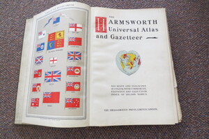
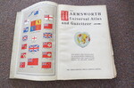
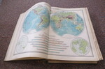
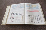
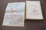
Reference 4003 (2243) Category Maps; Author Harmsworth Title The Harmsworth Universal Atlas and Gazetteer of the World: 500 Maps and Diagrams In Colour With Commercial Statistics and Gazetteer Index of 105,000 names Publishing Information London: The Amalgamated Press, circa 1908 Description No date but the Army statistics in graph go up to the 1906-07 year: xii, 210pages +110 map indices, 32, 284 page index. "With 500 maps and diagrams in colour, with commercial statistics and gazetteer index of 105,000 names". Double-page colour maps throughout each with its own title-page & index map. Frontis of Flags of the British Empire, two further leaves of flags, information on global industry and trade, index. Covers detaching, parts of text block loose, odd page loose but all complete and maps are nice and bright. Ideal candidate for rebinding. A very heavy Atlas. Price £65.00 Keywords ISBN Add this to your basket
