Polar Books Catalogue
-
Sections : Antarctic; Arctic; Journal of the Manchester Geographical Society; Maps; Miscellaneous; Mountaineering; General Polar; Scott; Other travel; Whaling;

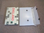
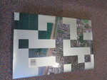
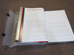
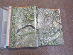
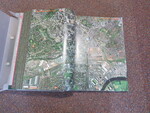
Reference 4043 (2278) Category Maps; Author Introduction by Cary Tristam. (Editors; Richard Atkinson, Philip Parker, Ian Harrison) Title England The Photographic Atlas Publishing Information London: HarperCollins, 2001 9780007122 Description 1st Edition. A stunning collection of detailed aerial shots of the UK, along with a a road map to the rear. From the same series as 'London: The Photographic Atlas' and 'Edinburgh: The Photographic Atlas. Original unclipped dustwrapper in original plastic briefcase. Text block firm, contents bright and clean. Slight bumping to corners. A very heavy book around 10kg! Text contains a standard grid system shared between the photography and the cartography, allowing the reader to quickly cross-reference between the two elements. A very scarce work. In the original unclipped dustwrapper. A fascinating work, a complete birds eye view of England, showing the entire country in detailed colour. This work took three years to compile, and is shown at a range of scales from 1: 4, 500 for city centres, to 1: 72, 000 for rural areas. With an introduction by Tristram Cary, who was the managing director of Gatemapping. Price £135.00 Keywords ISBN Add this to your basket
