Polar Books Catalogue
-
Sections : Antarctic; Arctic; Journal of the Manchester Geographical Society; Maps; Miscellaneous; Mountaineering; General Polar; Scott; Other travel; Whaling;
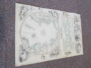

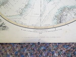
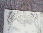
Reference 4050 (2285) Category Maps; Author Hugh-Johnson, J F.R.G.S. (Fullarton, A . Engraved by) Title The Arctic Regions Showing the North-West Passage as Determined by Cap.R.Mc Clure and other Arctic Voyagers. Wellington Channel, Melville Island Publishing Information London, Edinburgh: A. Fullarton & Co., 1856 Description 2 coloured maps on one sheet surronded by Arctic engravings of ships, wildlife, people etc., 1 map shows The Wellington Channel, Melville Island and surrondings from The Admiralty Chart. The other depicts The Arctic Regions and The results of Dr. Kane'sExpedition by favour of The Royal Geographical Society. This circular map is 25cm in diameter whilst the map of The Wellington Channel is 10.5cm x 23.5cm. A lovely piece of Arctic ephemera. The map has the Roman Numerals III on the top right and appears to have been cut from a large book or Atlas with some loss to the left hand side. There is a small closed repair tear to this side. Price £110.00 Keywords ISBN Add this to your basket
