Polar Books Catalogue

  • Sections : Antarctic; Arctic; Journal of the Manchester Geographical Society; Maps; Miscellaneous; Mountaineering; General Polar; Scott; Other travel; Whaling;

    Search for a book by author or title

    one or two words from the title should be enough
    + ensures a word is present, - excludes it
    Putting your search in " " means the exact phrase is searched

    I.e. South Polar brings all titles that have South and/or Polar in them whilst "South Polar" will only bring those titles up that have South Polar in that order in them


    Click for Full Size image: 300 x 225 (40011 bytes)
    Select for Full Size image: 300 x 225 (40011 bytes) Select for Full Size image: 300 x 225 (33085 bytes) Select for Full Size image: 300 x 225 (29768 bytes) Select for Full Size image: 300 x 225 (35362 bytes) Select for Full Size image: 300 x 225 (28957 bytes)
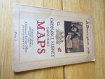
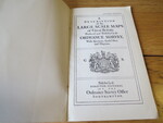
    Reference 4079 (2311)
    Category Maps;
    Author The Ordnance Survey
    Title A DESCRIPTION OF THE LARGE SCALE MAPS OF GREAT BRITAIN Produced And Published By The Ordnance Survey With Specimens, Symbol Sheet, And Diagrams
    Publishing Information Southampton: Ordnance Survey, 1930
    Description 4th Edition: 20 pages plus 11 plates. Covers browned and staple marks to inner page edges where bound to spine, contents clean.
    Price £5.00
    Keywords
    ISBN
    Add this to your basket