Polar Books Catalogue
-
Sections : Antarctic; Arctic; Journal of the Manchester Geographical Society; Maps; Miscellaneous; Mountaineering; General Polar; Scott; Other travel; Whaling;


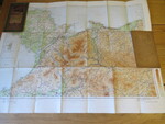
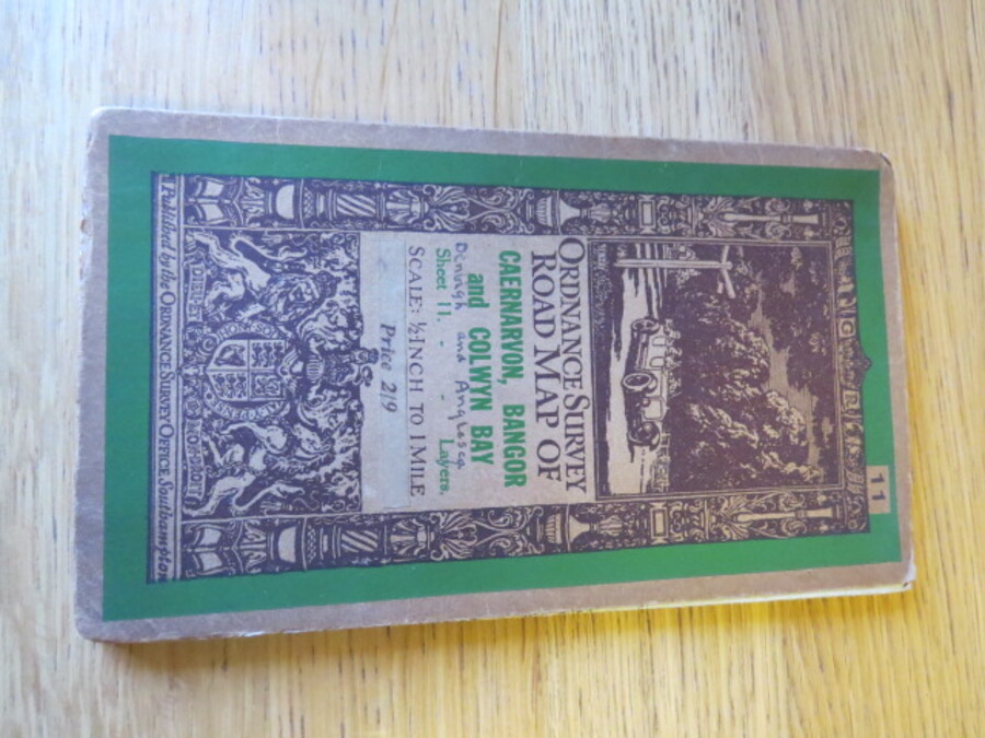
Reference 4101 (2333) Category Maps; Author Ordnance Survey Title Ordnance Survey Road Map of Caernarvon, Bangor and Colwyn Bay. Sheet 11. Layered Edition. Scale Half-Inch Inch to One Mile Publishing Information Southampton: Ordnance Survey, 1928 Description Reduced from the One Inch map of 1903-04. Published 1913, minor corrections 1923-28. Reprint 3000/28. Folding coloured map on cloth measuring 56 x 76cms folding in 22 panels to approx. 19 x 11cm. Scale Half Inch to One Statute mile 1:126720. Denbigh and Anglesey written on front cover by previous owner. The famous Half-Inch Layered Hill-Shaded Edition, with 'car passing signpost' artwork by Ellis Martin, was first published in 1925. Tiny pin holes at bisections of folds as usual. Price £20.00 Keywords ISBN Add this to your basket