Polar Books Catalogue
-
Sections : Antarctic; Arctic; Journal of the Manchester Geographical Society; Maps; Miscellaneous; Mountaineering; General Polar; Scott; Other travel; Whaling;

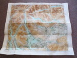
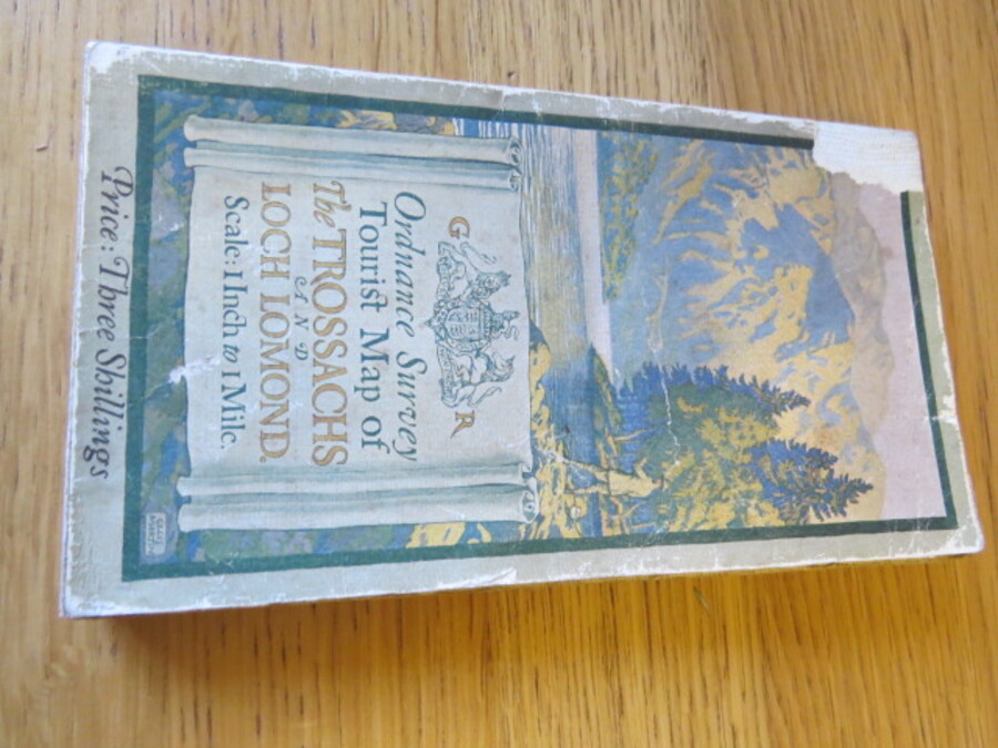
Reference 4103 (2335) Category Maps; Author Ordnance Survey Title Ordnance Survey Tourist Map of The Trossachs and Loch Lomond: 1 inch to 1 mile. Cloth Map Publishing Information Southampton: Ordnance Survey, 1920 Description Surveyed 1854-71. Revised 1895 and in 1904. Printed in 1920. Folding coloured paper map mounted on linen measuring 63 x 98 cms folding in 40 panels to approx. 18 x 10cm. Scale One Inch to One Statute mile 1:63360. Depiction of Gentleman fly fishing on the Loch artwork by Ellis Martin. Small holes and the odd small split to the cloth along some sections of folds. Part of front cover missing. Price £10.00 Keywords ISBN Add this to your basket