Polar Books Catalogue
-
Sections : Antarctic; Arctic; Journal of the Manchester Geographical Society; Maps; Miscellaneous; Mountaineering; General Polar; Scott; Other travel; Whaling;

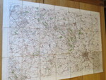
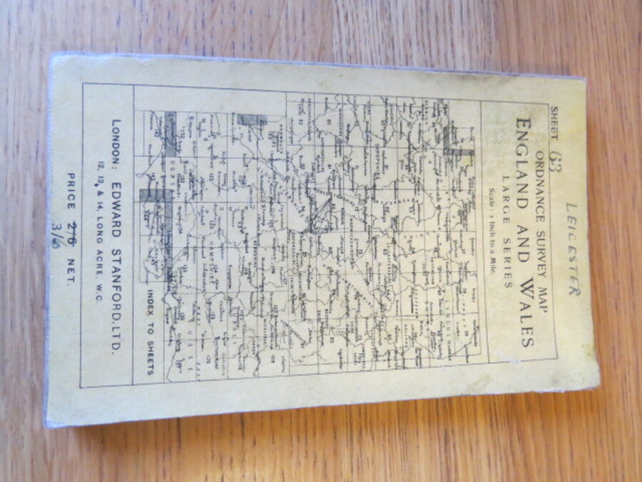
Reference 4104 (2340) Category Maps; Author Ordnance Map Office and Edward Stanford, London. Title Ordnance Survey Map England and Wales. 1 inch to a mile. Large Series Sheet 63 (Map of area of Leicester) Publishing Information London: Edward Stanford, 1911 Description Third edition, revised in 1905, published by the OS Office, Southampton in 1909, railways revised to May 1912. Folding map mounted on linen. Buff cloth backed card covers when folded, lettered in black with printed index to sheets to front and Stanford's details as seller. Coloured engraved map backed with linen. Size 53 x 76cm folds into 21 sections. Folded it is 18 x 11cm. Light wear including a few tiny pinholes at bisections. Price £10.00 Keywords ISBN Add this to your basket