Polar Books Catalogue
-
Sections : Antarctic; Arctic; Journal of the Manchester Geographical Society; Maps; Miscellaneous; Mountaineering; General Polar; Scott; Other travel; Whaling;
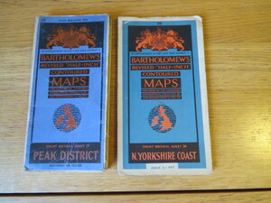

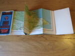
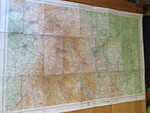
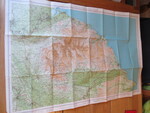
Reference 4112 (2342) Category Maps; Author Bartholomew, John Title Bartholomew's Revised Half Inch Contoured Maps x 2 Maps: Great Britain, Sheets 29 and 36, Peak District and North Yorkshire Coast Publishing Information Edingburgh: John Bartholomew & Son Ltd., Description 2 maps, 1 paper folding, 1 paper folding mounted on cloth. Sheet size red paper map mounted on linen measuring 57 x 83 cms folding in 27 panels to approx. 20 x 11cm. Scale Half Inch to One Statute mile 1:126,720. Small holes, tears, some mended along some sections of folds. Price £5.00 Keywords ISBN Add this to your basket
